Patagonia is located at the southern tip of the American continent and shared between Chile in the West and Argentina in the East. Carved by centuries of geological movement, Patagonia is about 440,362 square miles in size and divided into five provinces, Neuquén, Rio Negro, Chubut, Santa Cruz and Tierra del Fuego. Patagonia is a land of contrasts, home to jutting mountains, steep cliffs, ice caps pouring bluish tongues into lakes, pampas, southern forests, and also a sightseer coastline hiding many natural gems that combine to form a landscape of rugged beauty… a region of a thousand facets ! So, are you ready to join us in the epic adventure of the English travel writer and novelist Bruce Chatwin on a spellbinding journey through the pristine wilderness at the end of the world when writing your own version of In Patagonia ?
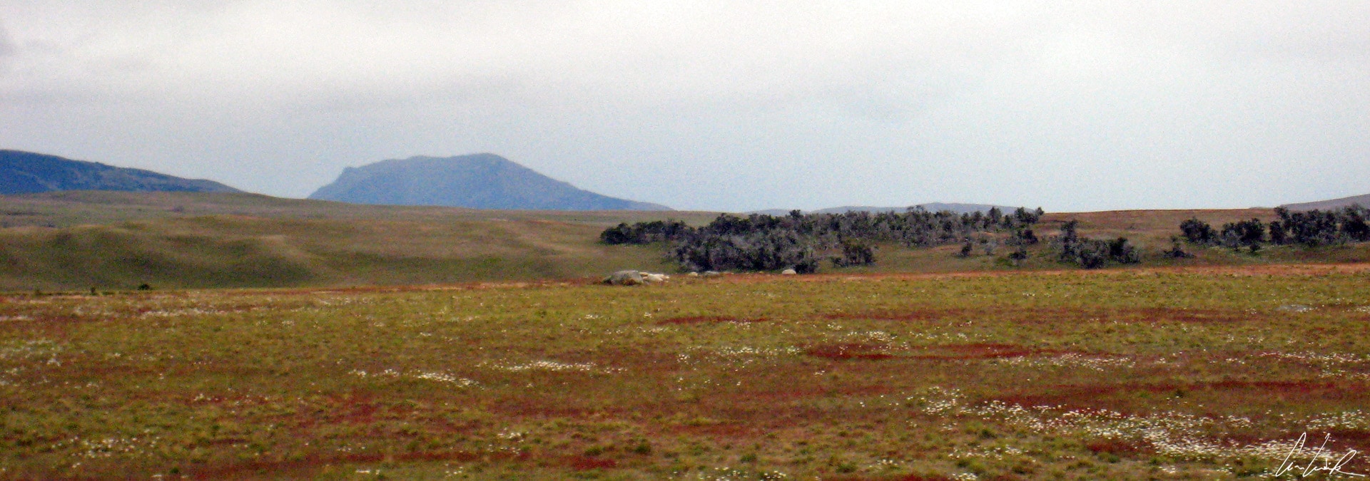
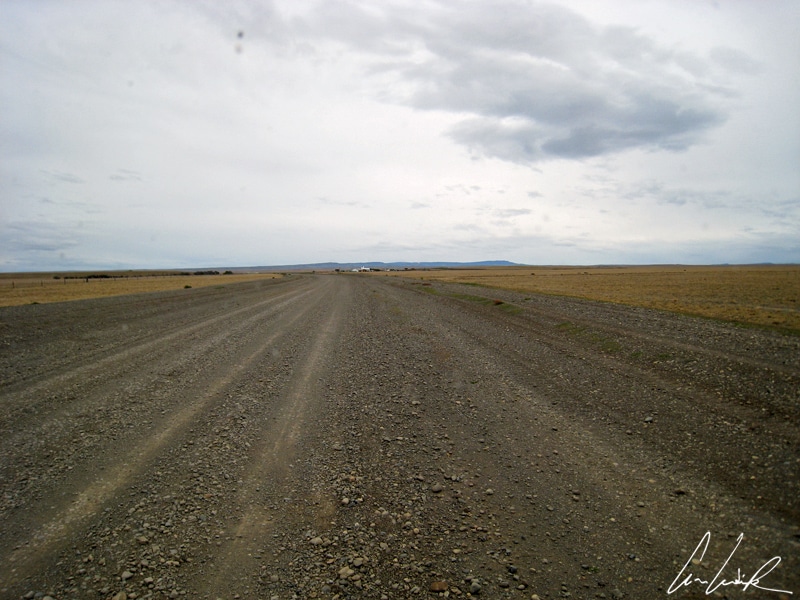
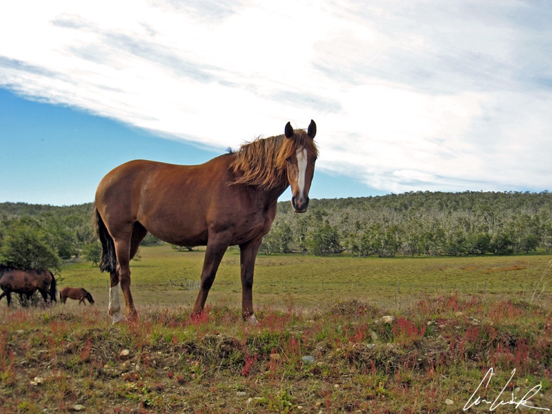
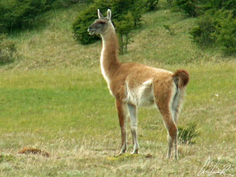
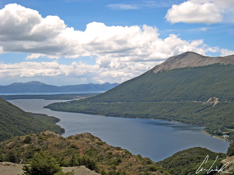
Patagonia appears to us as if in a dream: windswept and arid steppes as far eyes can see (apparently, rain only falls horizontally!), sprawling sheep farms and endless lonely roads… You can travel hundreds of miles without seeing anyone. Only a few horses and Ilama-like guanacos wandering freely in the landscape. Here you have the challenge of an immense and unspoiled landscapes at the end of the world! The Garibaldi pass built in 1956 at 1,476 feet above sea level offers a startling panoramic view, to the South Lake Escondido and to the North the silhouette of Lake Fagnano. The Garibaldi Pass is the only road across the Fuegian Andes and also the highest point on Argentina’s Ruta Nacional 3, 37 miles North of Ushuaia… Lake Fagnano also called Lake Khami or Cami, which means “large water” in the Selk’ nam language and is located on the main Island of the Tierra del Fuego archipelago. Lake Fagnano is one of the largest in the world. The lake stretches 61 miles from East to West between the Argentine village of Tolhuin at the Eastern end and Chile and the Strait of Magellan in the West. It covers 249 square miles and has a maximum depth of 656 feet. The Ona natives called it “the rest of the horizon” because the line of the Cordillera chain is interrupted by the lake. The surroundings of the lake are mainly forested but degraded by fires…
Cap San Pablo, a superb path
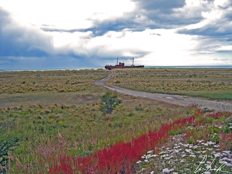
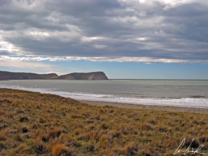
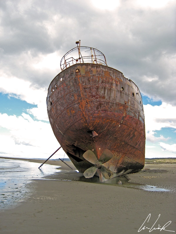
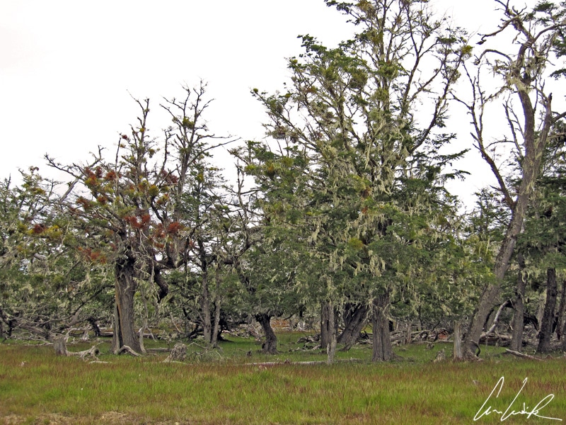
Finally, la route s’arrête / devant l’océan / dans l’aube tiède du levant / c’est l’ultime escale / la fin de l’errance / avant que j’ose le silence by French singer (Terre), translated as the road ends / in front of the ocean / in the warm dawn of the east / this is the last stop / the end of wandering / before I dare the silence, the Atlantic coast is in our sight. Between Rio Grande and Ushuaia, a detour takes us to Cap San Pablo, a place where hills, forests, rivers and ocean meet. A superb path leads us to a beach and a marker commemorating the wreck of the Desdemona. Just like the famous character from Shakespeare’s Othello, the Desdemona had a tragic end running aground in 1985 on a trip from Comodoro Rivadavia. The 253-feet long cargo vessel was built in the early 1950s in Hamburg. Its rusty hull still filled with bags of cement from Comodoro Rivadavia, and its heavy chain and anchors are planted in the sand a hundred meters in front and on the port side of the wreck… At low tide, one can go completely around the wreck. The sound of the metallic plates banging and squeaking in the wind gives a feeling of mystery to this surreal scene… ¡Qué copado! We head back on the road to the mythical destination of Ushuaia, the last city before the Antarctic continent. On the way, we admire the trees of the southern forests, their trunks tortured by the harshness of the climate. Most of the trees are covered with Barba de Viejo (beard of an old man) or “Barba del Diablo”. It is also sometimes called the beard of Saint-Antoine or the beard of Jupiter. This gray-green lichen gives the trees the appearance of ghostly ancestors and testifies to the excellent quality of the air… Indeed, this lichen indicates pure oxygen because it develops only in areas without contamination.
The Ushuaia Bay
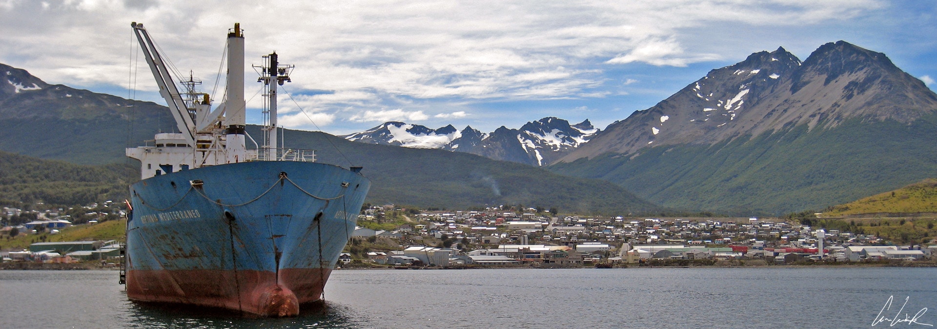
Ushuaia, the name of the city, comes from the indigenous yaghan, ush which means at the bottom of the wuaia, a bay or creek. The city is nestled on a wide bay between the snowcapped Martial Mountain Range on the North side and the Beagle Channel to the South. Ushuaia founded in 1884 on the banks of the Beagle Channel, and in 1885 became the capital of the Argentine province of Tierra del Fuego. Ushuaia is regarded as the southernmost city in the world. The Argentineans consider Puerto Williams on the Chilean side is too small to deserve the name of a city ! Moreover, the Secretary of Tourism of Argentina used the slogan of “End of the World” and made it an advance base for the discovery of the 6th continent… As a historical anecdote, a penitentiary was built here in the early 20th century. The first inmates were mainly re-offenders, dangerous prisoners, and political prisoners. These prisoners have contributed to the development of the local economy, especially by exploiting the timber from the forest around the prison. They also built a railway known as the “End of the World” train.
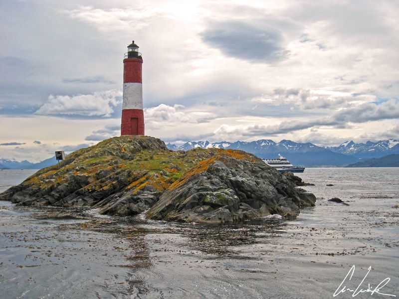
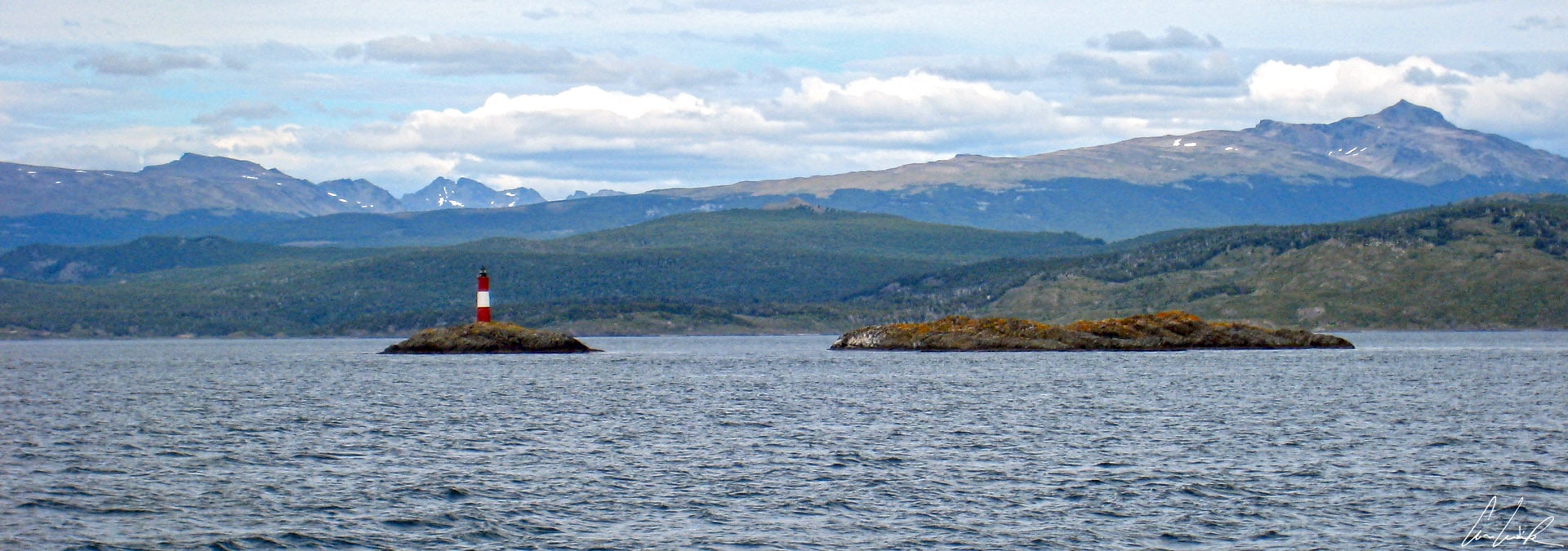
The Lighthouse at the end of the world
The Beagle Channel offers very pleasant short boat tours from Ushuaia. The Channel separates the larger main island of Tierra del Fuego from various smaller islands located to the south and belonging to Chile (Puerto Williams). Besides the Straits of Magellan to the North and the Drake Passage to the South, The Beagle Channel is one of the three navigable passages between the Pacific and the Atlantic Ocean. The Beagle Channel is about 150 miles long and 3 miles wide at its narrowest point. The channel was named after the British ship “HMS Beagle”, which surveyed the coast from 1826 to 1830 under the command of Captain Robert Fitz-Roy and with Charles Darwin, author of “The Journey of the Beagle” (1839), on board. After crossing the Channel from East to West, the “HMS Beagle” sailed for almost five years, Vogue, Vogue, my pretty little boat, a song by Paolo Noel: South America, Africa then Australia… But let’s return to the present and depart from the local port to observe the southernmost city in the world. We first admire the bay of Ushuaia with its sailing ships, the wreck of San Cristobal, the slender tops of Mount Olivia, the Mount of Five Brothers (Cinco Hermanos), Mount Escarpado, Estancia Fique y Tùnel, The Encajonado river… and the coast with its vegetation tortured by the winds. We then reach the “Les éclaireurs lighthouse,” known as “The Lighthouse at the end of the world“. The lighthouse is located 74 feet above sea level, is 33 feet high and 10 feet wide, and painted red-white. It started operation in 1920. It is not to be confused with a smaller lighthouse on the Eastern end of the Isla de Los Estados, the San Juan de Salvamento Lighthouse, built in 1884 and made famous by Jules Verne in his novel The Lighthouse of the End of the World “Le phare du bout du monde”. Verne’s work, published in 1905, relates the adventure of the guardians of the lighthouse fighting with pirates…
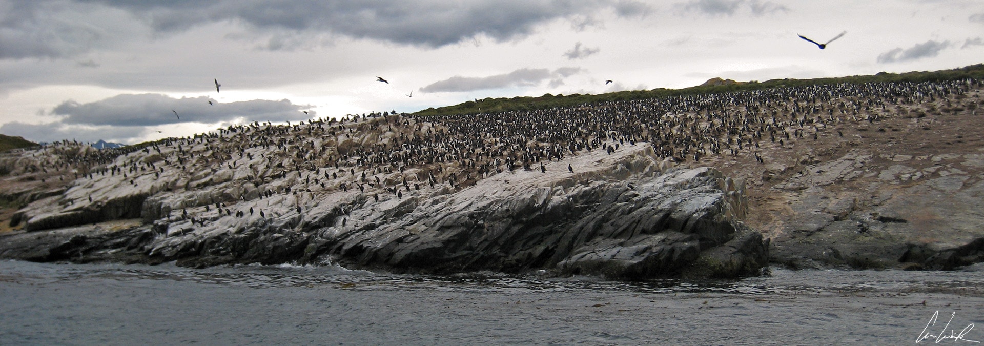
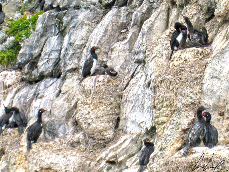
Imperial cormorants
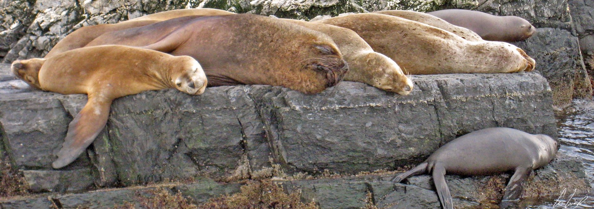
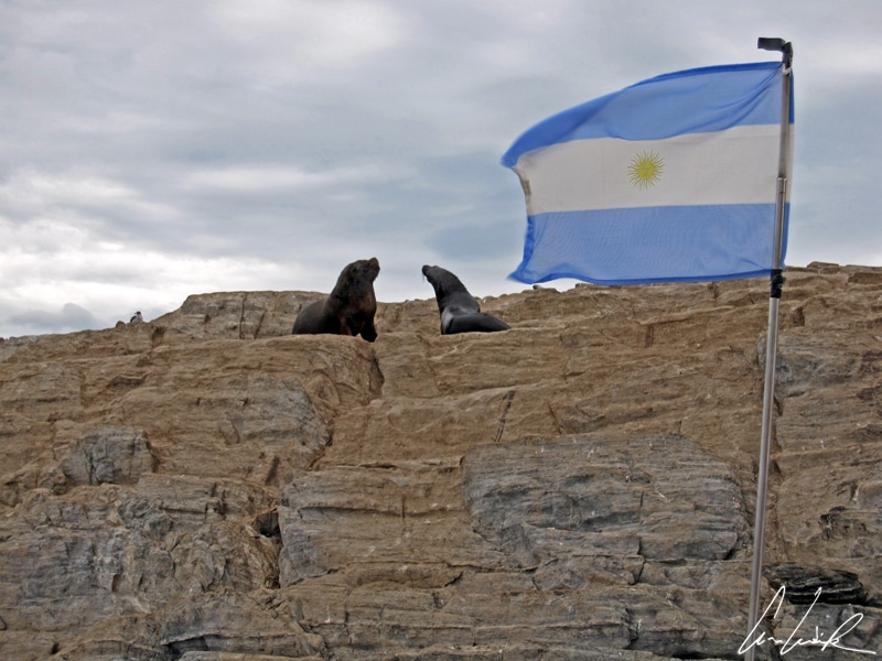
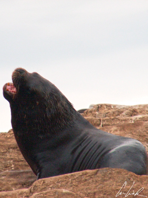
Here, both Oceans fight to mark their territory, and the Pacific wins by pushing back the Atlantic. The currents created bring plankton and mollusks that attract much fish, which in turn bring large numbers of Sea Lions, Fur Seals, and Cormorants for a feast. The small islands of the Channel are colonized. The Isla de Los Pájaros (The Island of Birds) is a good spot to admire Magallan cormorants, the majestic Imperial cormorants, albatrosses, petrels, fullman, giant petrels and 20 different species of sea birds… Isla de Los Lobos is a refuge of fur seals and sea lions. These mammals, excellent swimmers, share their existence between sea and land, where they settle down only to rest and breed. Related to seals and walruses, they live in colonies and are polygamous. The male commands a harem which it defends by impressive roars and fighting.


Really amazing place, and such stunning photos! A part of me regrets never getting as far south as Patagonia. Your writing makes it sound so magical and romantic!
Thank you :-). Patagonia is like a dream: windswept & arid steppes as far eyes can see, sprawling sheep farms and endless lonely roads… I hope you will have the opportunity to go there !
Wow, beautiful pictures. Such big skies, everything looks so epic!
Thank you so much ! Patagonia is really an amazing place ! You can travel hundreds of miles without seeing anyone except few horses and guanacos wandering freely in the landscape 🙂
You are so lucky to have visited a place I am dying to go to! Patagonia is breathtakingly beautiful. We could not go last year due to Visa issues(damn the Chilean govt) but I dream of going there some day. Loved the photo of the lighthouse!
These photos are just a small taste of the vast, fascinating region. There is no end to the wild, diverse landscapes you can find there 🙂 Seeing the famous Les Éclaireurs lighthouse was a magic moment !
I loved Patagonia so much but wish I could have spent longer in Ushaia. I love wildlife and would have liked to do some more tours. Thanks for reminding me of the beautiful memories
I loved Patagonia too 🙂 Patagonia is really an archetypal landscape of the imagination: vast and empty, wind-swept and barren ! It is home to an abundance of wildlife.
Gorgeous photos and great info in the post! I’ve been to Argentina but didn’t make it to Patagonia while there, this post has me wanting to travel back! I love that light house ❤️ It’s so cute!
Thank you 😉 Patagonia is as unique as it is enormous; a place where chunks of ice as large as double-decker buses break off vast glaciers into the ocean below. It is an untamed wonderland home to some of the few remaining uninhabited places on Earth and ecosystems and habitats that are rife with wildlife !
Such a stunning place – it seems so magical! I would love to visit there one day. I’m also kind of inspired to go look up Jules Vernes’ The Lighthouse at the End of the World and go read that now… 😉
If you are over 10 years old, I believe you are ready for the book as Jules Verne wrote it. He intended his writing to be read by all ages 🙂 And Patagonia is really magic: the huge dome of the sky, tufts of coirón grass bursting through the desert, a solitary guanaco keeping watch from a hilltop !
Patagonia is SO high on my bucket list. It looks incredible! As well as Ushaia since its the gateway to Antarctica! Lovin the wildlife pics!! 🙂
Patagonia is a wonder of the world. It is an area of fabulous biodiversity, home to many species classified as endangered or vulnerable.
Ok, putting that book in my “to read” list! I have mostly heard of this place as a location to wait when the Antarctic cruise prices go down or to come see birds, so I was interested to see that there are more aspects as well! Not that birds and cruise is not enough, it was just interesting that few other guides cover other topics at all!
I’d always liked reading Jules Verne and I’ve read most of his novels 🙂 Patagonia is home to an abundance of wildlife. Many species such as guanacos, birds or other small mammals can often be sighted along hiking trails and by the roadside without too much effort.
You’ve captured the place beautifully,it really does look like the end of the world! The lighthouse looks really cool, I love the idea of the guardians guarding it against the pirates. it must have been lovely to see some of the wildlife there too.
Vast and empty, wind-swept and barren, Patagonia is an archetypal landscape of the imagination ! You’ll feel like you’re on top of the world. You can march with the penguins or hang out with the most adorable sea lions 🙂
Love your photos! I’ve always wanted to visit Patagonia. It looks like you had such a great experience. I can’t wait to visit too!
Nature grows wild, barren and beautiful: space are large ! Don’t miss the spectacular sights of El Calafate and El Chaltén, but remember that they’re a world apart from the solitude of the steppe 🙂
Simply stunning! I’ve been wanting to go to patagonia for the longest time! it’s very high on my bucket list!
In its enormous scale, Patagonia offers an innumerable wealth of potential experiences and landscapes !
This is high on our list! Thanks for your great post. Love the photos
Thank you 🙂 Sure, you must visit Patagonia in your lifetime !
Such beautiful photos. I can’t wait to see it in person one day!
Thank you 😉 Patagonia is really an amazing place: vast and empty, wind-swept and barren 🙂
Wow! That sounds like an amazing experience. It has been on my bucket list for a while and you are giving me the itch to book it and make it happen 🙂
Patagonia offers an innumerable wealth of potential experiences and landscapes 🙂 Sure, you must visit Patagonia in your lifetime !
Patagonia is probably one of the most beautiful places on earth!
Even now, many years after being there, I never saw landscapes like these.
I fully agree with you 🙂 Coastal treasures, magical lakes, ancient forests and impressive glaciers, these do all belong to Patagonia’s delights !!