When we talk about Cuba, the first images that come to mind make our head spin and fill us with desire: Salsa, cigar and mojitos, a Cadillac from another time, colonial architecture, lobsters, white sandy beaches, and colorful fish. However, Cuba is much more than all this… The country has a strong and unique identity, marked by Communism since the end of the 1950s, by its multiethnic population, and by its mesmerizing culture of music and dance… Time seems to have stopped: there is Spanish colonial architecture, 1950s-era cars, bicycles, horses, people playing dominoes, ladies in the street, and even at the end of the day people sitting on the front steps of their house for the last gossip of the day… This country, full of contradictions, does not leave you indifferent. It is both dazzling and decadent… So let yourself discover a country, which resembles no other !
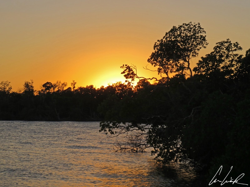
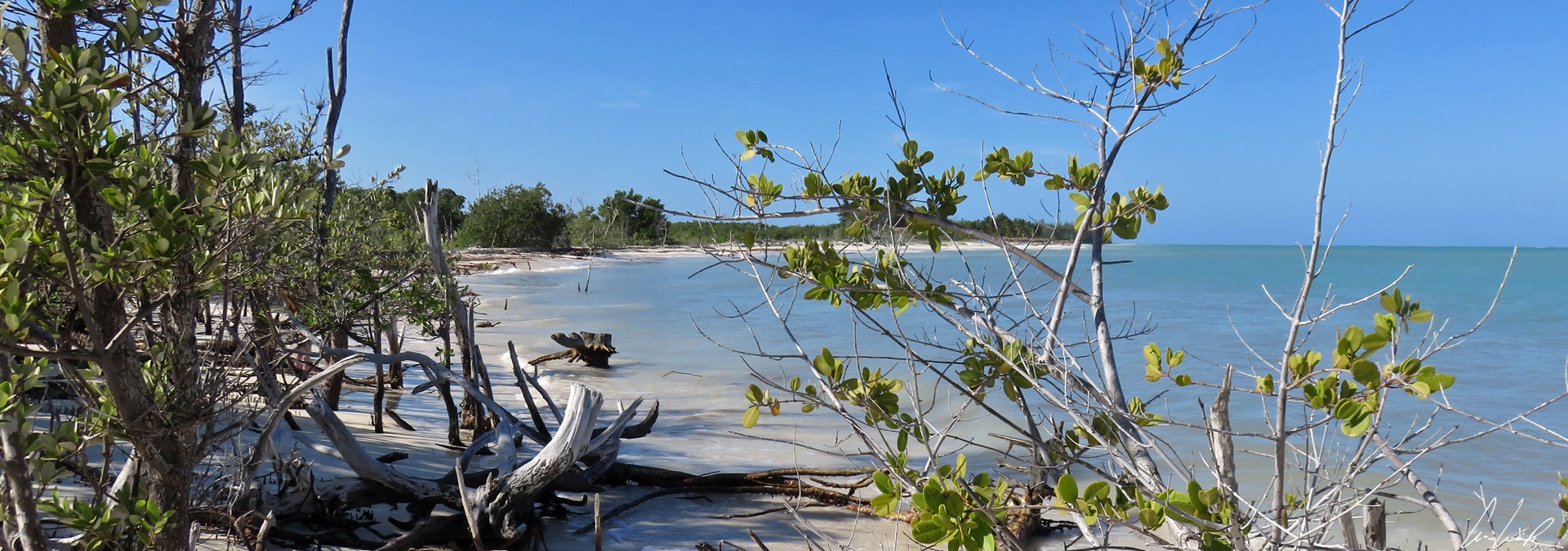
Cuba is the largest island in the Caribbean with an area of 42,426 square miles. It is 745 miles long and varies from 20 to 131 miles in width. Cuba is South of Florida, North of Jamaica, West of Haiti, and East of Mexico. It is nicknamed the “Crocodile” because of its elongated shape. It is also full of Cayos, small islands, and islets in the Caribbean Sea – white sand and turquoise water, like picture postcards ! But to get to Cayo Levisa, an island off the coast of the province Piñar del Rio and the first stop on our trip, is a trip through road sign hell. There are very few road signs, but ever so many billboards covered with revolutionary slogans and glorifying Fidel Castro and Che Guevara… It is late afternoon when we finally arrive at the port of Palma Rubia (located in the west of the country in the province of Piñar del Rio). A thirty-minute ferry ride brings us to Cayo Levisa… The sun is setting, and the light is just magic. The silhouettes of mangrove trees stand out like thousands of Chinese shadows against the orange sky !
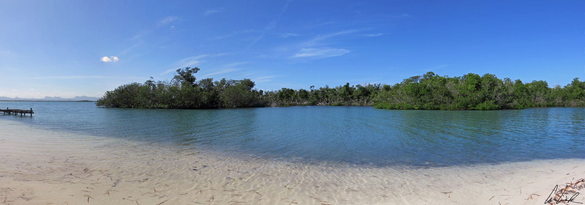
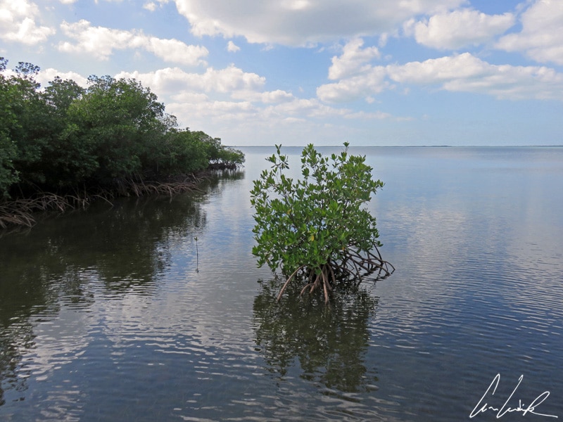
Cayo Levisa, Mangroves
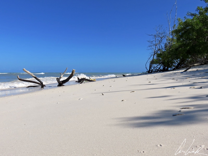
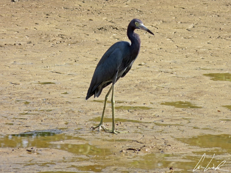
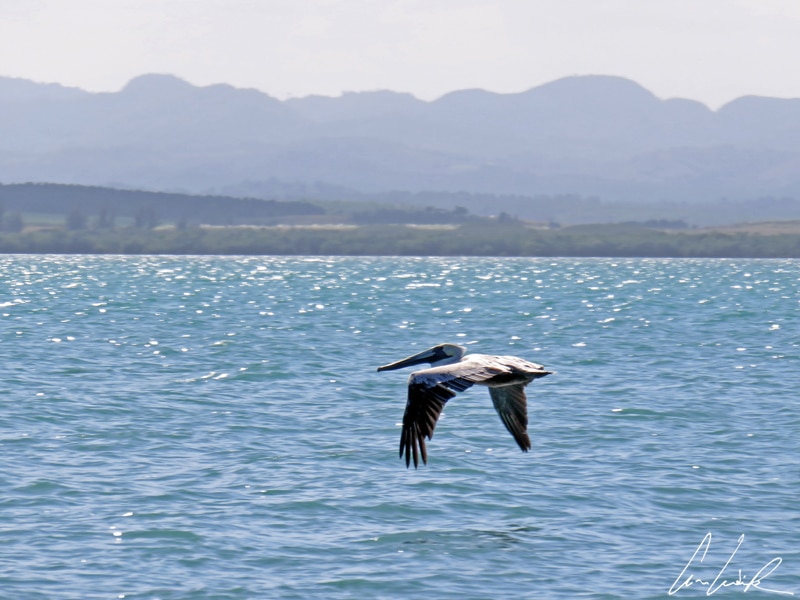
Cayo Levisa in the Los Colorados Archipelago is a small island about two miles long, a half a mile across at its widest point, and covering 0.58 square miles. The Southern part of the island is entirely covered by mangroves, and sometimes they seem to move along on their roots… Many species of birds populate the mangroves such as the sandpiper also called the “beach runner” because of his behavior. The Sandpiper moves very quickly on the beaches and is, therefore, hard to photograph ! In the North of the island, we find an endless beach of fine white sand—the image of paradise ? We walk to the second beach of the island, Punta Arena. Here we find sandbanks bordered by a turquoise sea and the omnipresent mangrove that seems to retake land from the ocean… Along the way, the only inhabitants we meet in this paradisiacal place are a Blue Egret (Egretta caerulea) and “my friend the pelican” flying like an airplane… But why does this nursery rhyme go through my mind, “De tous les oiseaux de la terre / qui volent au-dessus de la mer / y en a un que je préfère / Il vole comme les avions / mange pour pêcher les poissons / se pose comme un papillon / près des rivages ensoleillés / devant les plages abandonnées,” translated as “Of all the Birds of the earth / flying over the sea / the one that I prefer / flies like an airplane / catches fish to eat /and lands like a butterfly / on sunny shores / in front of deserted beaches.”

Cayo Levisa, Starfish (Oreaster reticulatus)
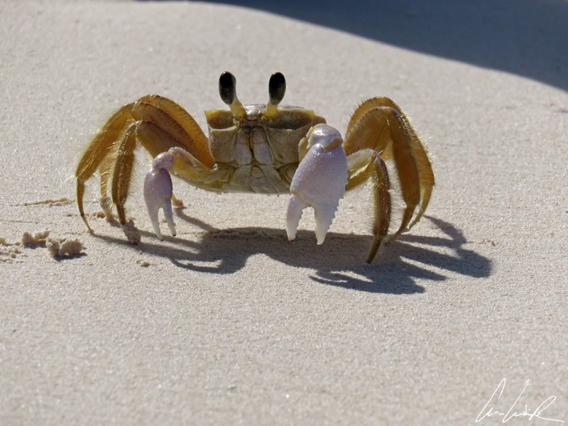
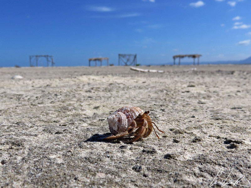
When we arrive at the beach of Punta Arena, there are no crowds… just crabs, mollusks, crustaceans, and fish. Un p’tit crabe tout bronzé / sur le sable allongé / je le prends dans ma main / je l’entends qui se plaint… translated as “A little crab all tanned / lying on the sand / I take it In my hand / I hear he who complains…” Ouch, ouch, pinch me, I dream, we are alone in the world like Tom without Wilson ! No, I see natives: a small Hermit crab that climbs over every pebble like a mountain and gigantic starfish wearing the bright colors of the genus Oreaster reticulatus. They are also called “red cushion sea star” or “West Indian sea star” and measure about 20 inches in diameter… “Go, old branch (five total), we go back to play hide and seek among the waves ?”… But the water is so clear that nothing can be lost 🙂 … We return to the main beach, giving a final glance at the lovely turquoise sea. Is it time to go back to the pier or not… Quizás, quizás, quizás… to take the boat with these images still dancing in front of our eyes and head to Viñales, 50 miles away.

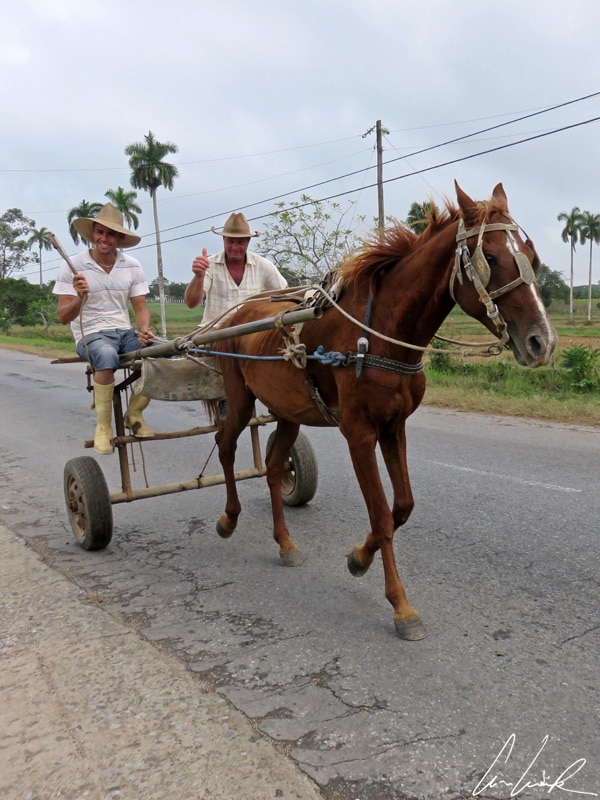
Viñales, « Caballos » ride…
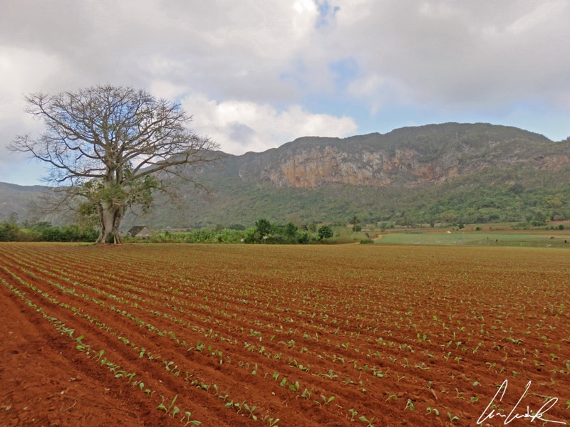
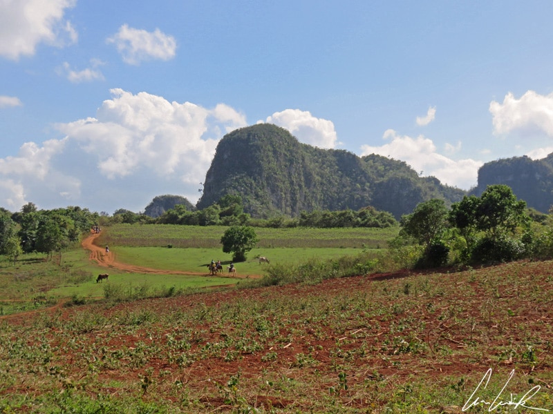
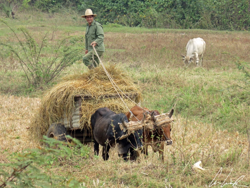
The Cordillera de Guaniguanico is the spinal column of western Cuba that runs 99 miles from the center-west in Piñar del Rio Province to the western part of Artemisa Province. It is a mountain range that resembles a Jurassic “Gruyère” full of extensive systems of caves, particularly near Viñales. The Pan de Guajaibón is, at 699 feet above sea level, the highest point in the Piñar del Rio. Of course, when you get closer of Viñales, you notice the Limestone Mountains covered with thick pine forests, interrupted by layers of brick and ocher colors. The rocky outcrops eroded and chiseled by time into forms known as “mogotes” and are characteristic of the countryside around Viñales. The pine forest that forms the background landscape of Viñales gave its name to the region and its capital: Piñar (Pine Forest) del Rio. The Viñales Valley is a natural reserve and a UNESCO World Heritage Site since 1999. You have to enter it on foot, on horseback or by bike to appreciate its beauty. We opted for a few hours of “Caballos ride“… On the small country trails, bouncing along at the pace of the far from timid horses, we pass fields of sugar cane, coffee and tobacco dotted with “bohio”, the huts in which tobacco leaves are drying. Tobacco is cultivated by “guajiro”, pushing a plow behind a pair of harnessed oxen (a natural tractor !) Tobacco growing is the chief occupation of this region and farmers still use “old-fashioned” farming methods 200 years after their introduction. The traditional method is a choice. Tractors are heavy, and they pack the soil down contrary to what tobacco needs. The plant needs a rich and well- drained soft soil. The annual production of the Viñales Valley is approximately 66,000 tons per year. Christopher Columbus and his companions were the first Europeans to become familiar with tobacco… it is said that one of Columbus’s close colleagues was so passionate about the first cigars in history that he smoked one every day all the way back to Spain ! As a result, we can legitimately ask ourselves the following question: between the New World and the cigar, which of these two discoveries by Christopher Columbus was more important ? I am sure you have enough information to answer this question yourself…

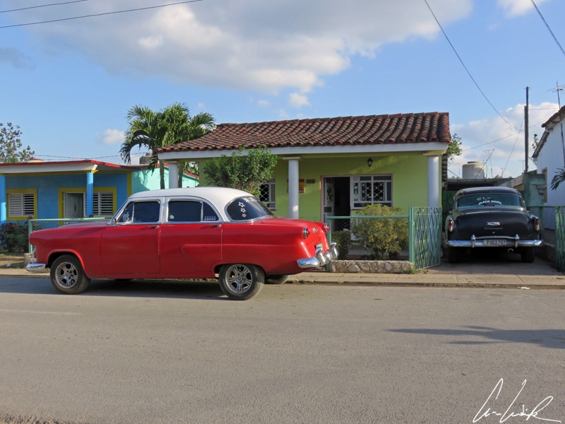
Viñales, old car
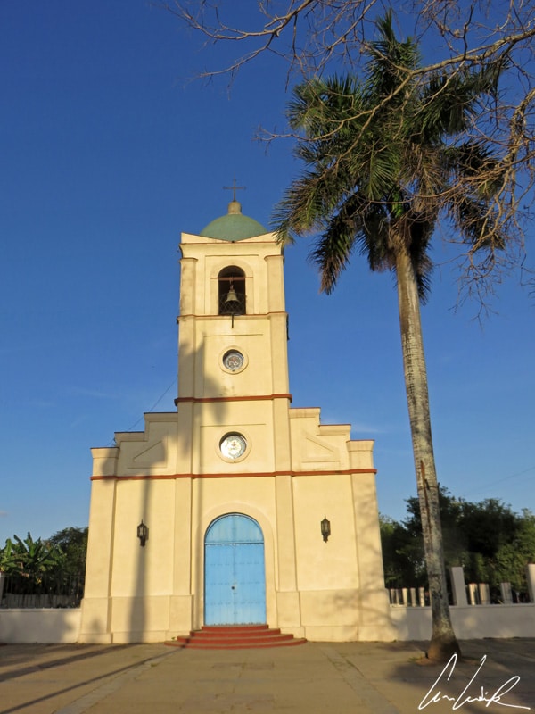
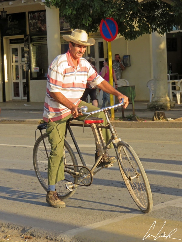
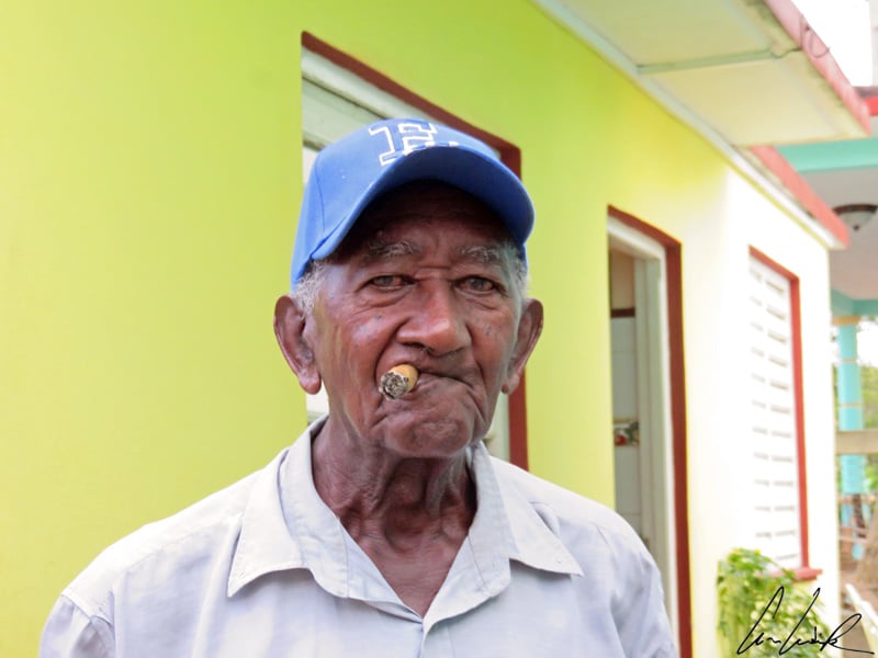
Viñales is a small, quiet town founded in 1607 in North-central Piñar del Rio Province. The streets are lined with colorful houses among which it is pleasant to wander at the end of the day and observe local life. Sitting on the main square with its lovely yellowish church, one can be carried away by the coming and going on the main street: pedestrians, cyclists, handcarts and of course the great old cars. A little further on, in a parallel street, there is a kind of sweetness of life… we can see locals rocking quietly on their front porches while smoking a cigar…
Hasta La Vista !


I love your pictures! Colorful and peaceful!
Thank you 🙂
Okay so this post is seriously informational and I love it. I am the first to admit I don’t usually look past the “cigars, old cars, salsa dancing” thoughts of Cuba – it’s nice to know some history behind it all. Also I LOVE that photo of the star fish – it’s so cute.
Cuba is definitively a country, which resembles no other !
I can’t stop looking at your amazing picture of that starfish. So, so, good! We’ve been wanting to visit Cuba for a long time. My husband a bit skeptical, but every article that proves Cuba is awesome, helps build my case. Thank you for sharing this. Great photography !
Thank you :-). We were so lucky to see the starfish !
I’ve been thinking abut planning a trip to Cuba now that American’s can travel there! It looks so beautiful!!
It’s a beautiful island to visit ! So let yourself discover a country, which resembles no other 🙂
wow it is so nice, thats a really different post, we hear so much about the cadillacs and cigarrets that sometimes we forget that Cuba is not only about it!
Indeed, Cuba is much more than all this… This country, full of contradictions, does not leave you indifferent 🙂
Looks like you had an amazing time in Cuba! It’s quite high on my list now! 😀
It was an incredible journey ! You should definitively go there and let yourself discover a country, which resembles no other 🙂
The wildlife in the mangroves sounds amazing and this place really does sound like a tropical paradise. My uncle told me never to visit Cuba because he said there was a lot of thieving and con artists… but I never really listened to him because I believe everyone should make their own mind up. I think you might have swayed me way further in the positive for this place! Thank you!
The whole world is full of so many amazing places to see, great people to meet, delicious food to eat etc. so see it by yourself at least once ! Cuba is an extraordinary adventure I recommend to you 🙂
I love these old cars… They are so amazing and usually very colorful! Your post make me wanna go to Cuba so bad!
Old cars, Spanish colonial architecture, bicycles, horses, people playing dominoes etc. Time seems to have stopped !
I love this. It’s not every day you see posts that go beyond the typical cars and cigar shots of Cuba. I still haven’t been to Cuba yet but would love to explore beyond the usual.
Thanks you 🙂 . Cuba is much more than all this… It is worth to explore the place beyond the usual !
Such an informative and beautifully written post – thank you for sharing! I really didn’t know anything about Cuba before reading this… now I NEED to visit!
Very good :-). Cuba is an extraordinary adventure I recommend to you !
These photos are wonderful! And you’re right, Cuba is so much more!
Thank you 🙂 . Travel to Cuba is to dive into the heart of a story, both magnificent and terrible… This country does not leave you unchanged !
I’ve wanted to go to Cuba for so long! Its nice to read some different things about it. I wonder how much it will change with the increase in tourism!
I have always wanted to go to Cuba and your pictures are really enticing me to finally book a ticket!
The island you went to looks so peaceful, I would love to go onto that beach. The way you describe Cuba makes me want to go there so badly!! One day I will, hopefully before it’s ruined by tourists…
On Cayo Levisa, we could spend hours here in the company of some indigenous people: crab, Hermit crab, gigantic starfish, Pelican ! Cuba has still so many less crowded places to offer !
That starfish looks amazing. We went to Havana last month and we enjoyed it. Typical Cuba but your post sounds so amazing. I would like to go back and see these areas which are not as popular. I love the way you write.
Thank you 🙂 . For me Habana is a movie set lying somewhere between decay and sparkling beauty !