Góðan daginn
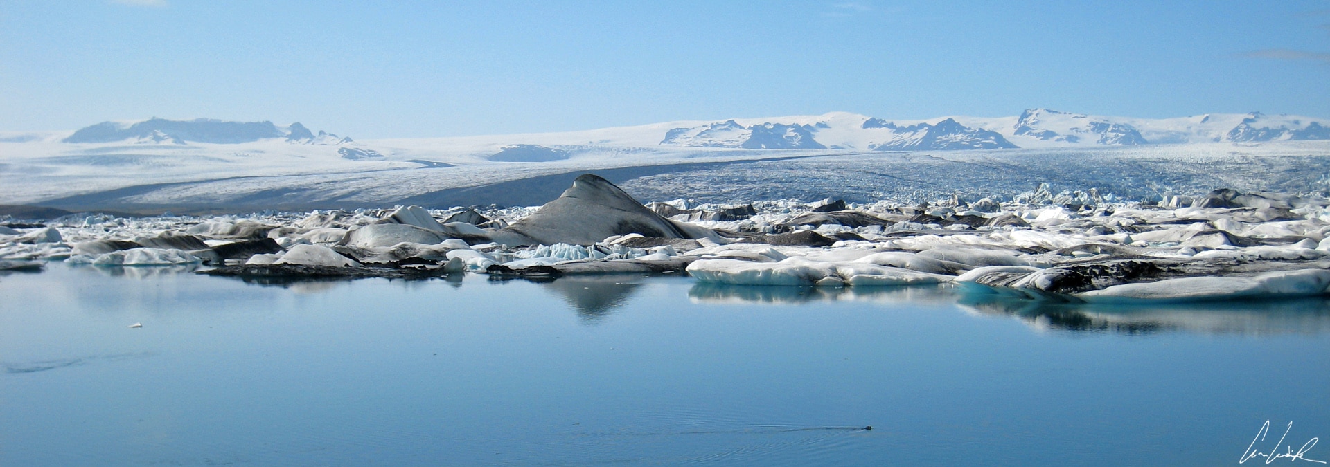
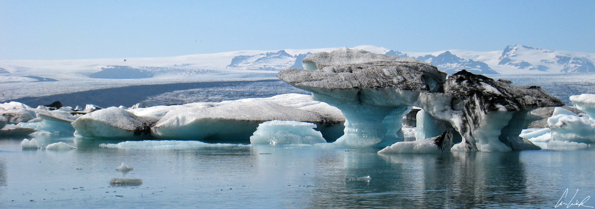
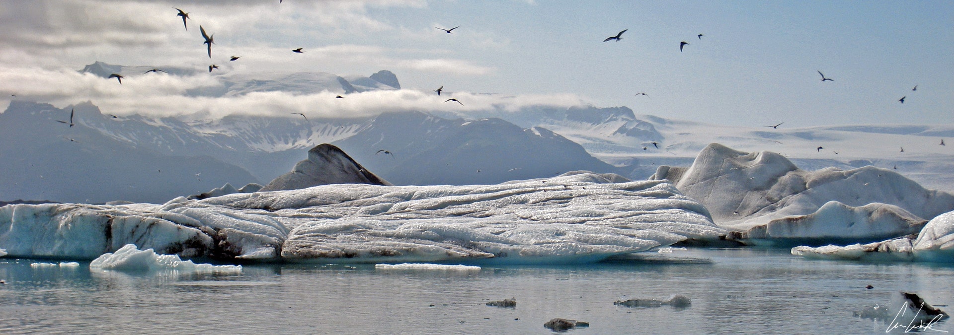
“Where the glacier meets the sky, the land ceases to be earth, and the earth becomes one with the heavens; no sorrows live there anymore, and therefore joy is not necessary; beauty alone reigns, beyond all imagination“. This quote from the novel World Light, Book Four The Beauty of the Heavens (Ljós heimsins) by the Icelandic author Halldór Kiljan Laxness epitomizes what we feel in front of the spectacle of the glacial lake Jökulsárlón, literally the Glacial river lagoon. The glacier is located in Southeast Iceland between Skaftafell Park and the city of Höfn, a 4-hour journey of 230 miles from the capital on Road 1. This glacial lake, one of the natural wonders of Iceland, leaves unforgettable memories for travelers whatever the weather. Magnificent icebergs spill from the tongue of the Breidamerkurjökull glacier and gather in the lagoon. They look like abstract sculptures floating on the lake surface. They are white, sometimes translucent, with blue or green hues depending on the compression of the ice and are streaked with black ash from frequent volcanic eruptions. After several years, the icebergs melt down into smaller ice blocks and roll out into the ocean through a narrow channel at the lake’s shallow end. They end their lives on the black sandy beach in small jagged cubes carried in by the tide. The contemplation of floating icebergs in the Jökulsárlón is disturbed only by the screech of Arctic terns. It is not uncommon to see seals lying on the icebergs or their heads emerging from the lagoon. They follow their food, shoals of herring and capelan, that drift in from the ocean along with the tides. Very curious, they also come to observe tourists !
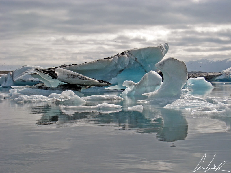
Jokulsarlon – Abstract sculptures
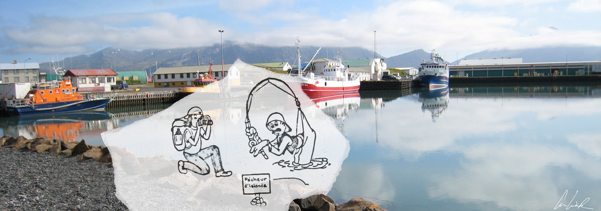
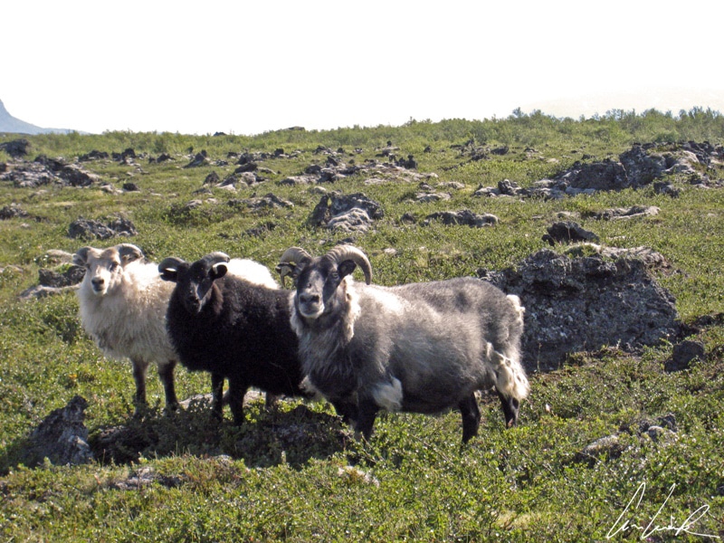
Since we are in the animal chapter, our path regularly crosses an iconic silhouette of the landscape: the small, pony-sized Icelandic horse, known in the equestrian world for its strength and five gaits. Indeed, he displays two gaits in addition to the walk, trot and canter/gallop commonly displayed by other breeds, the tölt and pacing. The tölt, a 4-beat lateral ambling gait, is known for its explosive acceleration and speed, attaining 18 to 25 miles per hour, and very comfortable for the rider. The breed performs another pace called skeið, flugskeið or “flying pace,” fast and smooth. Some horses can reach up to 30 miles per hour. The flying pace is a two-beat lateral gait with a moment of suspension between footfalls, each side has both leg landing almost simultaneously, left hind and left front, suspension, right hind and right front and so on. Icelandic horses live outdoors year-round in all weather conditions in semi-liberty: The little horse ‘mind winter’s height / ah, what a gallant heart he bore / He was a little pony white / all behind and he before, composed by French poet Georges Brassens. Despite its pony size, an average of 52/56 inches and weight between 730 and 840 pounds, breeders refers Icelandics as horses. If it is not a horse beside the road, then it is a sheep. Like the Icelandic horse, sheep are ubiquitous in the Icelandic landscape and descend directly from herds taken to Iceland by the first settlers. Robust and undemanding, they simply eat poor grass. The sheep live outdoors from May to September and just before the first snow are brought in for the winter. Once they were used primarily to food, but today sheep provide a very high-quality wool. However, among the “musts” of Icelandic gastronomy, the sheep hold a special place: the svið (boiled sheep’s head), the sviðula (paté of sheep’s head), the kjötsúpa (mutton soup) and the hangijöt (smoked sheep)… Bon Appetit! But if you prefer succulent prawns… check out Höfn (or Horfnafjördur), pronounced “Heup’n,” 200 miles from Reykjavik, a significant fishing port with a beautiful view of the Vatnajökull ice field, if the weather allows it. Prawns are a specialty of the area !
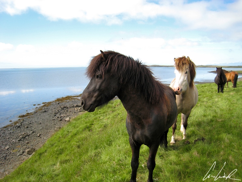
Icelandic horses
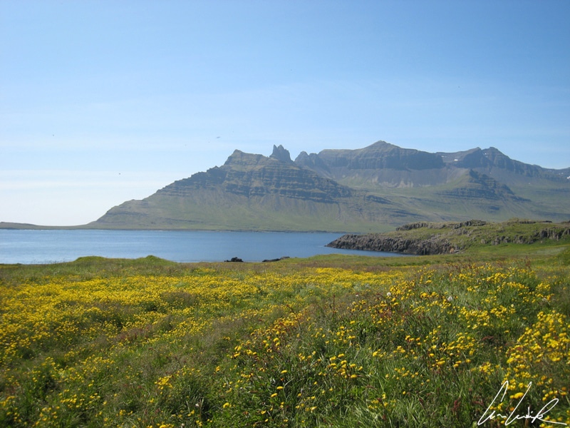
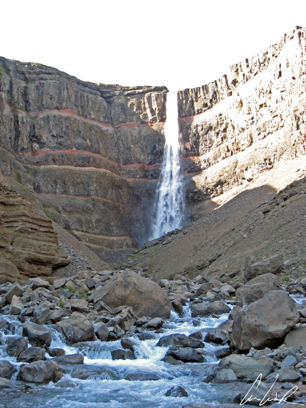
But let’s continue our cheerful journey along the famous Ring Road, or Route 1, towards the East of Iceland, an area full of valleys and wild mountains by the sea. The area is home to about 12,000 people living in villages scattered along majestic fjords. During summer evenings, a cloudy sky takes on a spectrum of pastel colors over desolate but gorgeous inlets–a landscape worthy of the Lord of the Rings. Beyond the fjords, we find lakes and waterfalls. In the Northeast of the island, the Hengifoss Fall is the pride of Fljótsdalur Valley. Hengifoss Fall, even if it does not seem as high as most of the falls in Iceland, is the third highest at 387 feet. It appears before a hiker in a ravine framed by basaltic strata walls with thin red layers of clay. Near Hengifoss Fall, we find Lagarfljót Lake. It covers an area of 20 square miles and 16 miles long and 1.6 miles wide. As with Loch Ness in Scotland, the lake is home to a legendary cryptid serpent, called lagarfljótsormurinn by locals, which is believed to live in the depths. Sedimentation makes the water very murky, and the existence of the giant serpent has never been proven. But who knows, maybe on a dark night, along a country road, while he was looking for a shortcut that he never found, David Vincent has seen it…
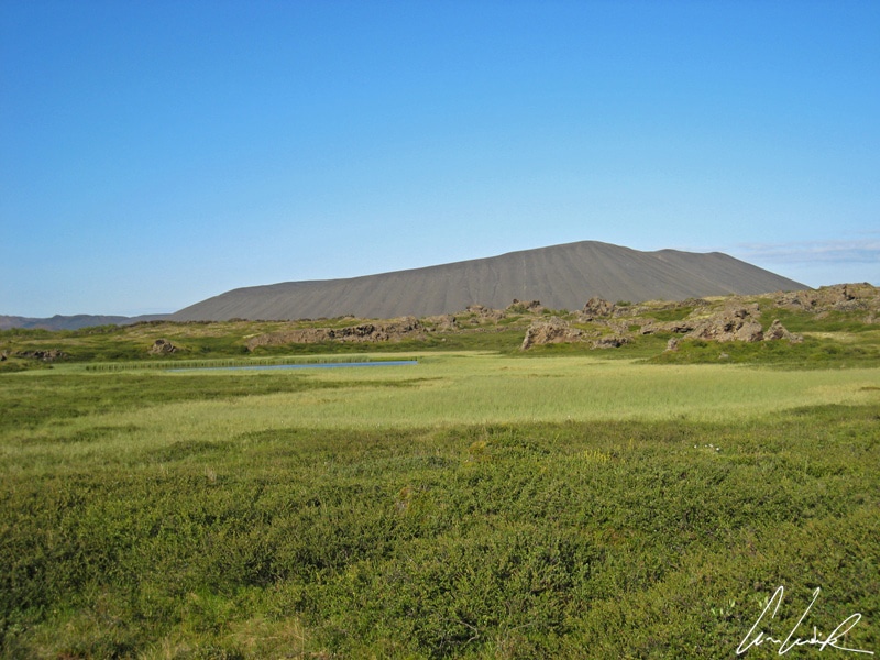
Krafla area
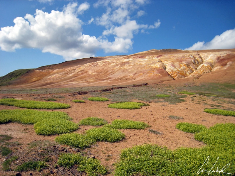
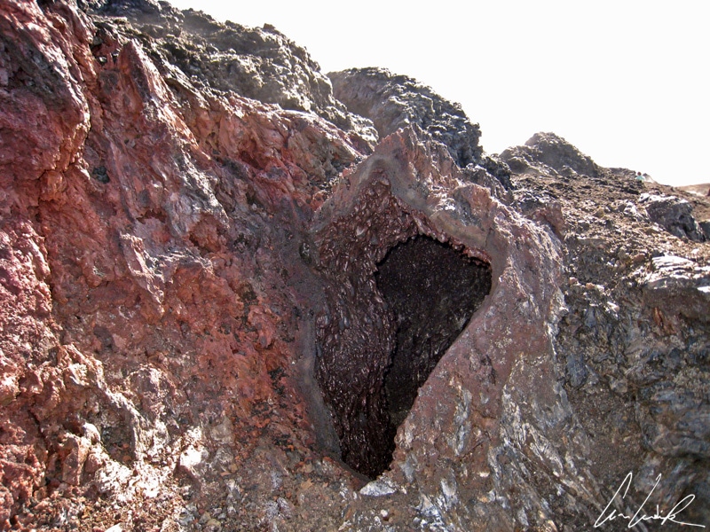
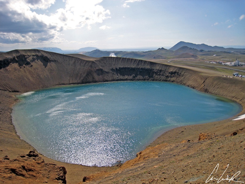
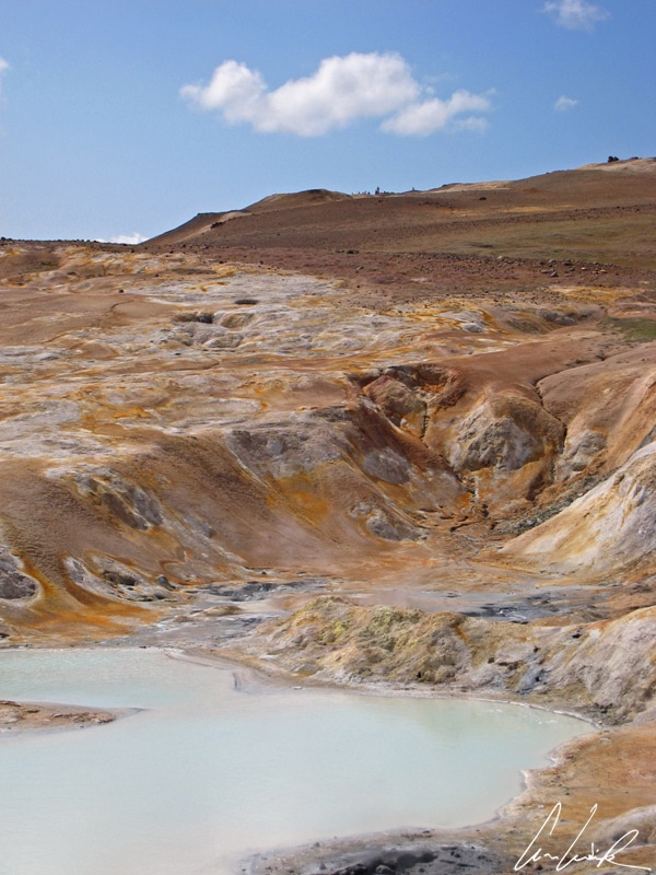
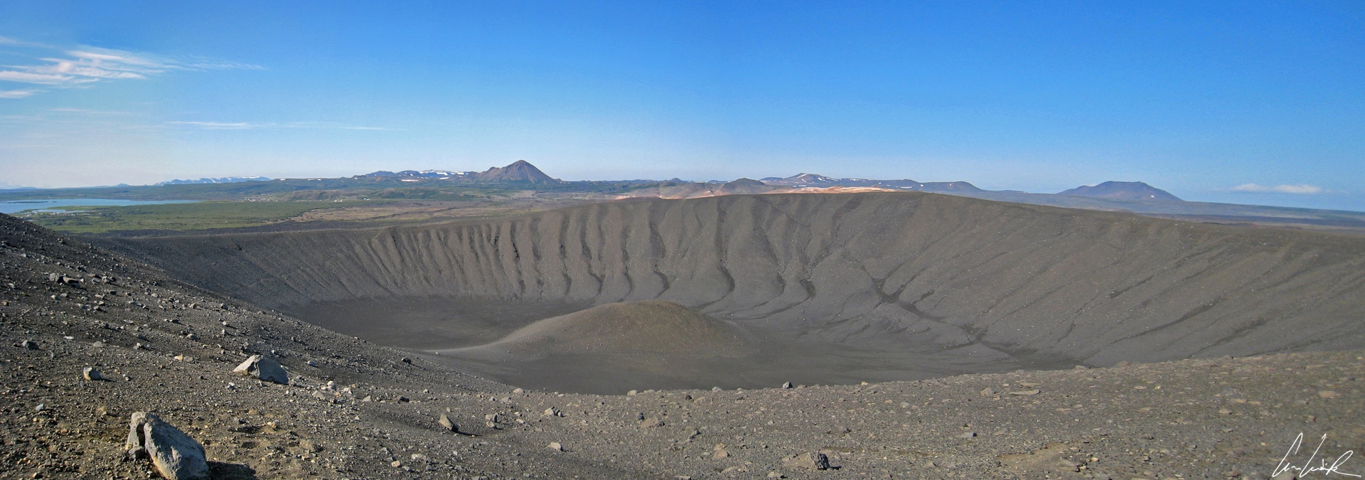
If you dream of an alien landscape, then the Krafla area is a must-see destination. It is located about 310 miles from the capital Reykjavik in the North of Iceland in the Mývatn region. Krafla is a caldera 6 miles in diameter on a 56-mile long fissure zone. Here, the earth’s crust is extremely thin, and the magma chamber is only 9,800 feet deep. Periodically, the soil in the area is uplifted a few centimeters due to magnetic outbreaks. The last eruption was in 1984 at the end of a period of intense volcanic activity called “the Krafla fires“, which lasted from 1975 to 1984. A fissure opened near the Krafla at the foot of Leirhnjukur and lava fountains gushed all along the fault. A path has been traced on the 1984 lava flow to permit close observation of craters, indented scoria cones, smooth plates, lava tunnels rimmed with red lava and smoking fissures and sulfur crystals, a feast for the novice and expert geologist alike. The Krafla region offers a variety of sites to explore. The crater Viti at the foot of Krafla has emerged from an explosion that marked the “Myvatn Fires” between 1724-29. The crater has a small turquoise lake from snowmelt. Behind the Viti, there are sulfur springs… the surface of the earth cracked, revealing yellow-orange-red colors, and releasing a strong floating smell of sulfur to accompany visitors along the trail.
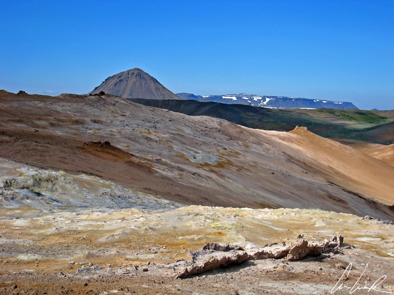
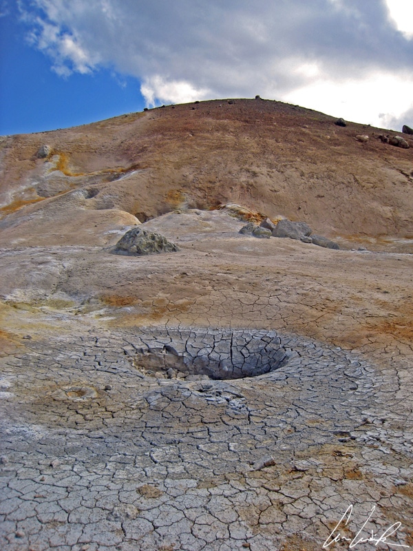
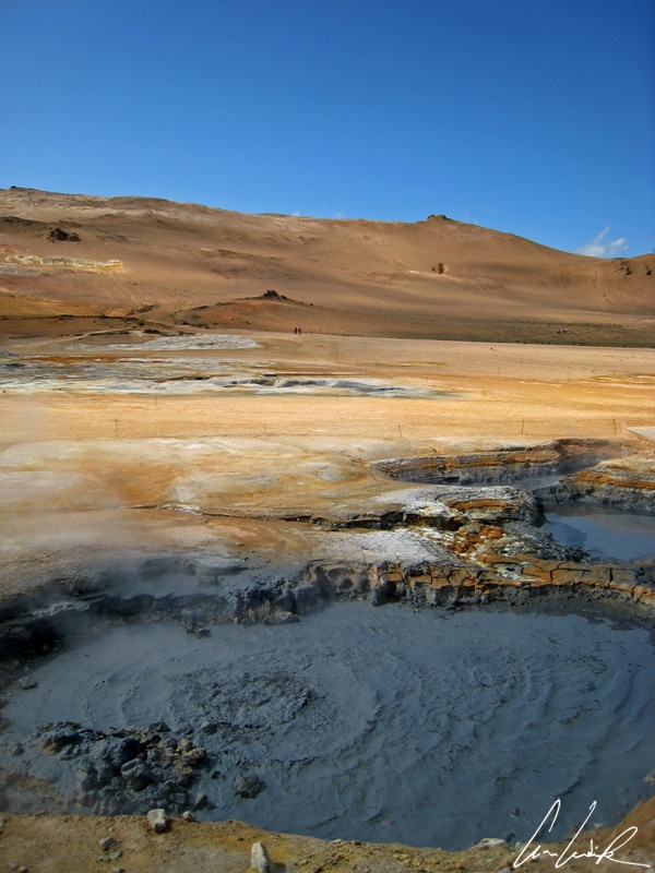
Hverir – Colorful sulfur deposits
Curls of steam with a strong odor of rotten eggs (oh, sorry sulfur) welcome the visitor to the colored site Hverarönd, also called Hverir, in the North of Iceland near the Krafla and one of the hottest areas of Iceland. Sulfur springs, bubbling mud pools, colorful sulfur deposits and fumaroles dot the ground at the foot of Namasfjall. This orange mountain is infused from all sides by acids and sulfuric vapors seeping from the ground. The boiling soil collapses into ever-expanding mud pools shaken by violent bubbling with each bursting bubble throwing burning mud on the bankbed. In these devil’s pools, the sulfuric water and acid dissolve the rock and forms a grayish and bubbling mud. The underground activity is impressive; the earth vibrates beneath our feet. The furious whispering of fumaroles recalls that the magma is close to the surface.
Also nearby is Dimmuborgir or “dark castles.” These black lava fortresses in unusual shapes, sometimes composed of wide doors, volcanic caves, and other rock formations, are gigantic lava pillars formed by erosion and a lava lake 1.5 miles in diameter. They form a perfect labyrinth for the traveler… Er einhver hér ? In this maze, you almost expect to cross the mountain spirit or some other gnomes in the bushes… but who is this face set in stone ? There, for sure you are ready to enroll at the Icelandic Elf School, the Álfaskólinn, the School of elves. But before you run to Reykjavík to register, one final step. After Dimmuborgir, we see the imposing silhouette of the Hverfjall volcano (the “mountain hot spring”), an imposing gray cone free of vegetation. Hverfjall is an ash crater about 1,000 meters in diameter formed by a single eruption about 2,500 years ago. A hiking trail allows us to climb and walk around the top. At the top, there is a 360 ° view of Lake Mývatn, Dimmuborgir, and the Krafla area.
Váá, takk rosalega.
Discover my others articles about Iceland


It looks really cold! But the photos are incredible! Interesting to see new places like this
The ruggedness of and stark contrasts present in Iceland’s landscapes makes them irresistible to photographers. Glacial floodplains, waterfalls, towering mountains, fjords and even deserts of volcanic ash can all be found in relative proximity to each other !
Iceland has been on our bucketlist for sooooooo long but traveling from South Africa makes the flights a bit pricey. Has anyone ever told you that your pictures are really amazing? Thank you for the awesome post.
Thank you 😉 The country may be small but it is very rich in nature and culture and filled with contrasts. With every turn of your head, you’ll feel like taking a picture. No matter what you like to photograph; nature, animals, people, daytime… you’ll be sure to find your picturesque opportunities in Iceland ! Visit in April, September or October, and you’ll trade accessibility for lower prices and reduced crowds.
I have wanted to travel to Iceland for so long! Your post about it is beautiful. I love your photos and how you incorporate quotes from books/poems. The Icelandic horses look adorable, and the landscapes look incredible! I love prawns…but sheep’s head would be pushing my limits ha ha.
Iceland is known for its otherworldly beauty, a landscape that includes extreme contrasts, all in one melting pot. It is a photographer’s dream destination ! Iceland is a once in a lifetime experience that everyone should definitively make plans for 🙂
Your photos are absoltely stunning. I’ve always wanted to go here. Did you think iceland was overpopulated with tourists when you went?
For any photographer interested in capturing images of stunning natural landscapes filled with raw power, Iceland is an absolute must-see. Getting to Iceland is cheaper and easier than ever so it will be more and more difficult to avoid the tourist hordes and enjoy the unspoiled solitude of the country’s wide-open spaces. The good news: if you drive away from Reykjavik, head off the Ring Road and avoid the Golden Circle, the crowds diminish and you’re left with far fewer people competing for space 🙂
While this definitely looks cold, is seems worth is for the scenery alone! OMG what a view!
Thank you 🙂 Most people come to Iceland to admire the nature – and it’s no wonder why ! There are picturesque glaciers, rivers and waterfalls just a stone throw away from colourful beaches, lush valleys and deserts. Even volcanoes underneath glaciers and hot springs surrounded by ice.
This place is on top of my bucket list and images on your post inspired me to hurry up ASAP to be there .. Cute little place for some soul searching !
Iceland is a once in a lifetime experience that everyone should make plans for. Not only is this country the perfect playground for both budding photographers, but it will leave you with vivid memories to last a lifetime 🙂