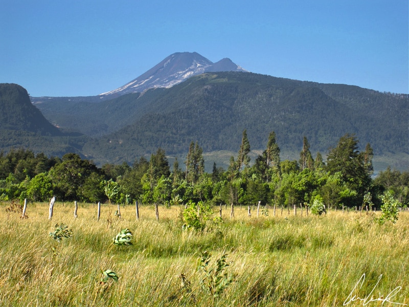
The Los Lagos Region or the Araucania in southern Chile is located 435 miles from Santiago and stretches between the cities of Temuco and Puerto Montt. It is a popular holiday destination for Chileans. The mildness of its climate and the beauty of the landscape attract vacationers. An agricultural and cattle-raising region, it is known for forests, meadows, and a dozen large lakes whose radiant blue waters are dominated by the snow-capped volcanoes of the Andes. The Araucania is the historical territory of the Mapuche (or Auraucans) people. The Mapuche resisted the invader and pushed them back to the Rio Biobío, the second largest river in Chile. The river originates in Galletué Lake in the Andes and flows 240 miles to reach the Gulf of Arauco on the Pacific coast. A place full of history and culture, you cannot visit this region without thinking of the story of the French lawyer Orélie–Antoine de Tounens, a native from Perigord and for some a fanatical mythomaniac and for others a brilliant adventurer who founded the Kingdom of Araucania and Patagonia. As the self-declared King of Araucania and Patagonia he was known as Orelie-Antoine Ist. He reigned from 1860 to 1862, relying on the indigenous tribes to fight the Chilean and Argentine authorities. He wrote a constitution, created a national anthem, appointed ministers, and introduced a blue-white-green flag. His story was the subject of a film by the American-Chilean director Niles Atallah, “Rey, l’histoire du Français qui voulait devenir Roi de Patagonie” (Rey, the story of the Frenchman who wanted to be king of Patagonia) The movie, dating from 2017, tells the story of this “self-proclaimed king” – a tale worthy of an adventure novel ! Let’s follow the footsteps of this mystic conqueror and discover his former kingdom of Araucania…

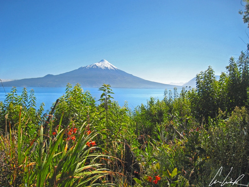
Blue waters are dominated by the snow-capped volcanoes of the Andes
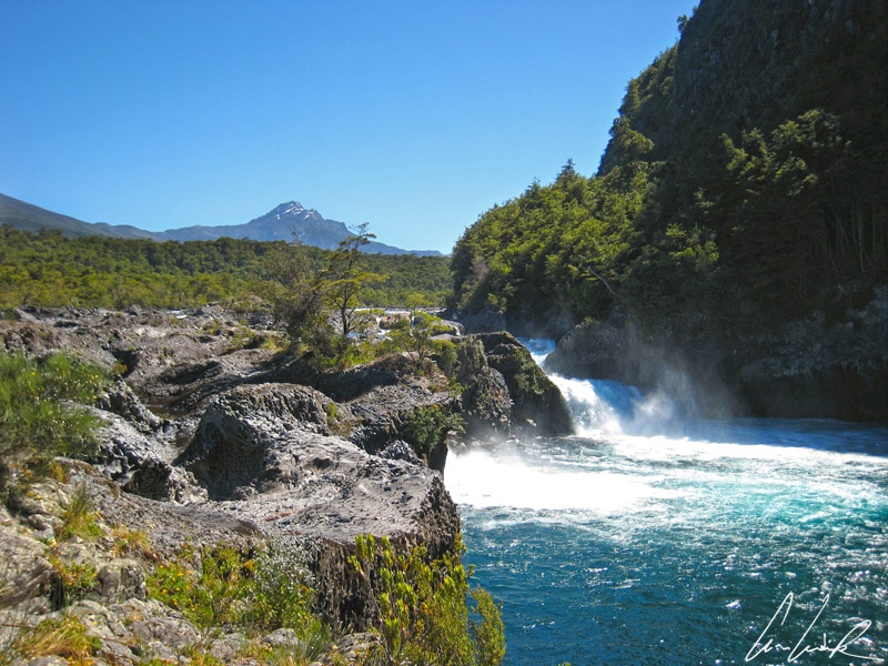
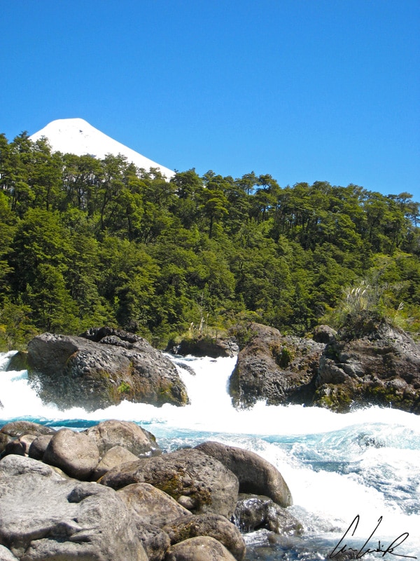
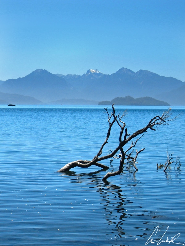
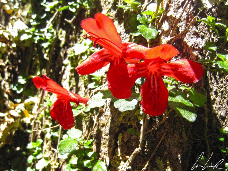
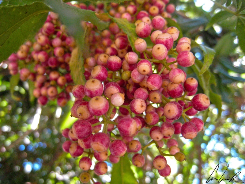
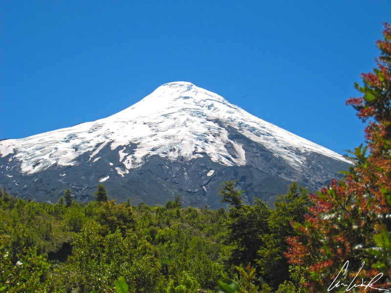
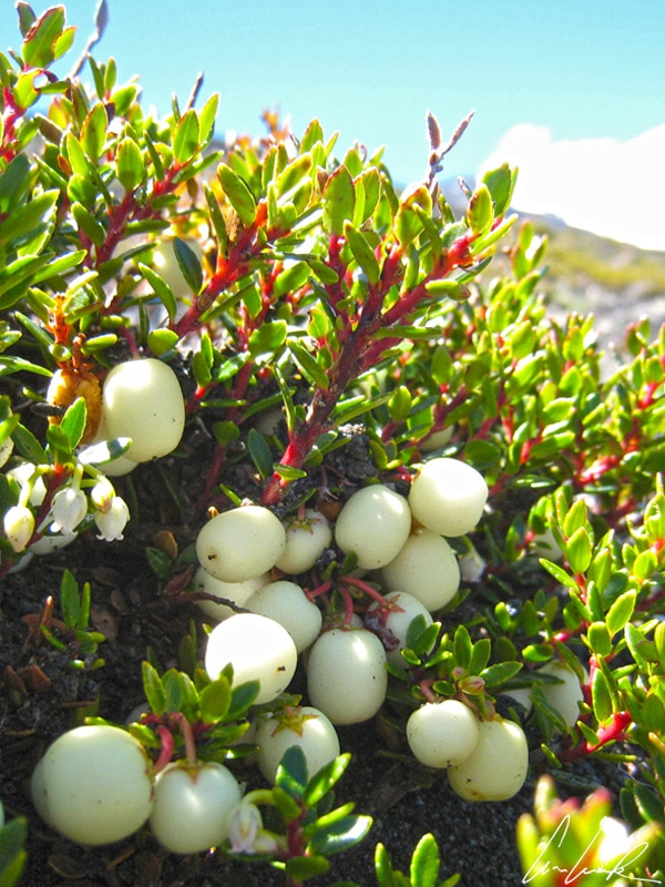
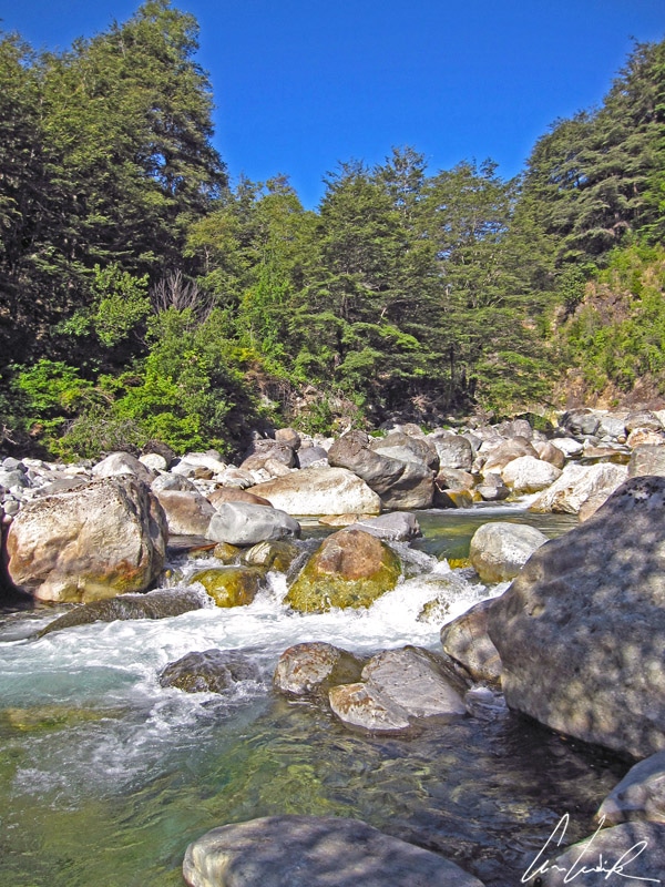
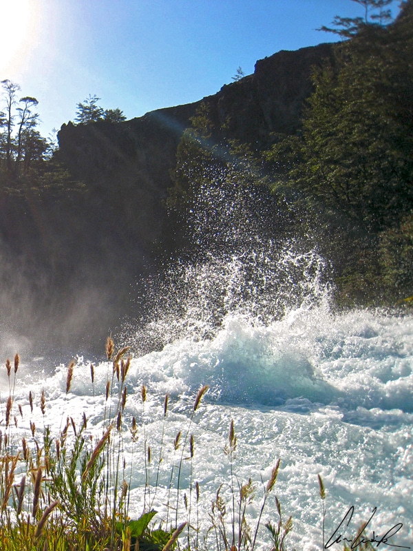
A journey to the heart of the region of lakes and volcanoes is total immersion in a pure nature. There is a jumble of tumultuous torrents, meadows, ancient forests, sharp reliefs, volcanoes with snow-capped peaks… a hymn to “Pachamama”, the goddess revered by the indigenous people. She is also known as the Mother Earth. Located between Ensenada and Lago Todos Los Santos, the Saltos del Rio Petrohué (Petrohué waterfalls) have carved the rock of the basaltic lava flows. In this volcanic area with surprising reliefs carved by the glaciers of another era, the emerald green and turquoise Rio Petrohué contrasts with the black rocks and green forests providing an interesting background for pictures. The white water river rushes over the rocks, and the roar could almost make us forget the magnificent view of the Osorno volcano above the trees. A short distance upstream is Lago Todos Los Santos (All Saints Lake), named after its discovery on All Saints Day by Spanish Jesuits missionaries… The lake, at 620 feet above sea level, covers an area of 68.9 square miles with a maximum depth of 1,106 feet and is located within the boundaries of the Vicente Pérez Rosales Natural Park about 60 miles northeast of the regional capital Puerto Montt and about 47 miles east of Puerto Varas. The lake marks the border with Argentina. The lakeshore is wooded shores and stretches over 80 miles in front of sky-scraping mountains from which sprout the snowy peaks of three volcanoes. The Osorno with its perfect cone lies to the west, the Puntiagudo with its needle summit to the north and the Tronador to the east. The Tronador along the border between Argentine and Chile is the highest summit of the region topping out at 11,463 feet and standing 3,300 feet above the surrounding mountains. The Lago Todos Los Santos was called “Esmeralda” (Emerald Lake) by the indigenous people due to its “Belle” emerald-colored waters… and not as a tribute to one of the main characters in Victor Hugo’s novel “Notre-Dame de Paris”. In this magical place, you are one with Mother Nature. We let ourselves dissolve into the fullness of the calm surrounding. It is pleasant to relax and follow the trails in the woods, admiring the rich flora that has found refuge around the lake. Climbing plants grow up over stumps to a height of 13 feet and produce flowers in the shape of a red cylinder (Asteranthera ovata); further away lie colorful clusters and a Monkey flower. But it’s time to get closer to the Osorno volcano, the so-called Mount Fuji of South America, whose snowy cone rises to 8,701 feet above sea level behind the vast Llanquihue Lake (330 sq mile.) Still active, the Orsono had 11 eruptions during the 18th and the 19th centuries, the last, however, was in 1869. It is a hotspot for winter sports enthusiasts with its two chairlifts, its permanent snow cover and its unequaled and spectacular panorama. The view of Llanquihue Lake, the surrounding mountains, and the forest are etched in your mind ! The flanks of Osorno are covered in places by cute little shrubs with tiny leaves and white fruit, edible, but tasteless (Gaultheria pumila var leucocarpa).

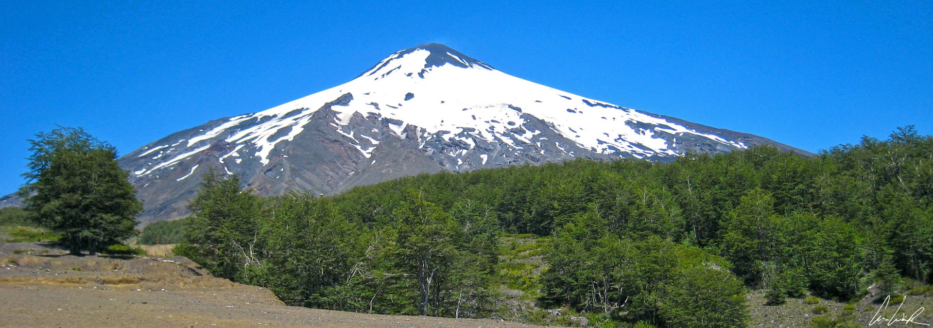
Villarica volcano
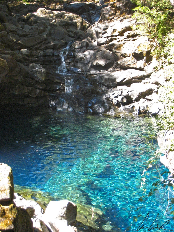
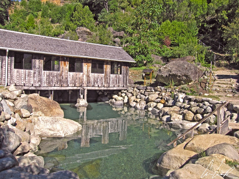
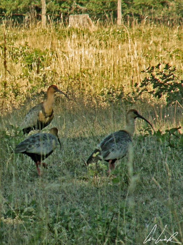
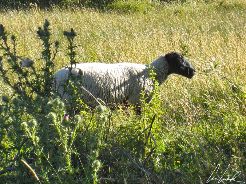
The Villarica National Park is located near the town of Pucón about 470 miles from Santiago de Chile. The park was established in 1940 and covers an area of 243 square miles. The centerpiece is the well-known Villarrica volcano. It is one of the most active volcanoes in the ring of fire with more than 80 eruptions since 1558. Rising 9,380 feet above sea level dominates Lake Villarrica and the city of Pucón. Its last eruption occurred on March 3rd, 2015 and forced the evacuation of over 3000 people ! The main volcanic risk comes from its ice cap. In 1971, after several eruptive cycles, pyroclasts were ejected, and the ice cap surrounding the crater melted creating an opening 3 miles long and a quarter mile wide on the northeast side that released nearly 30 million cubic meters of lava. The melting of a considerable amount of glacier ice and snow caused massive lahars, torrents of deadly mud, water, and rocky debris… Villarrica is also known as “Ruka Pillán” in the Mapuche language, meaning Pillán’s house. In the Mapuche mythology, the Pillán are good spirits, but also can cause disasters as a punishment. It is one of the three largest stratovolcanoes in the Andean chain. Despite the risk of eruptions, it is a popular destination year around. In winter, ski enthusiasts can drive up the northern flank of the volcano to a ski resort, enjoying the surrounding views and downhill skiing with nine lifts and 20 trails… Imagine being there, stuck on a chairlift like Jean-Claude Dusse, Étoile des neiges / Mon coeur amoureux / S’est pris au piège / De tes grands yeux… de Caburga ! (Star of the snow / My heart in love / Was caught in the trap / Of your big eyes… of Caburga ! It is true that one would be easily seduced by these blue-green eyes… Los Ojos del Caburgua (the eyes of Caburga) is an underground river which originates in the Caburgua Lake. This underground river comes emerges in three waterfalls each between 50 and 70 feet high around an eye-like opening surrounded by a beautiful lush forest. The limpid and crystalline water has sumptuous blue and green hues ! A few feet away upstream is the Laguna Azul, a pool of turquoise blue water. All this water, it makes you want to swim ? What about an outdoor spa ? I’d prefer warmer water ! But we are lucky because this area offers a range of impressive hot water springs and thermal pools, for the happiness of everyone. There are rustic and traditional pools for those who prefer authenticity and want to enjoy the beautiful scenery. Others are modern and luxurious while still others are in the heart of nature, isolated, almost inaccessible, ideal for those who are looking for adventure and thrills. We opt for Thermas Los Pozones located on the banks of the Rio Liucura about 20 miles from Pucón. Los Pozones offers seven natural pools made of rock of different sizes and at temperatures ranging between 86 °F to 108 °F. The style is rustic but you will undoubtedly succumb to its charms, its solitude and the surrounding silence… as well as its local fauna, including the black-faced Ibis and its buddy, “Shaun” the sheep also black-faced… Are they part of the “Black Gang (ship)” ? Ah, ah, they might manage the fire room of the Thermas Los Pozones !

Los Ojos de Caburgua
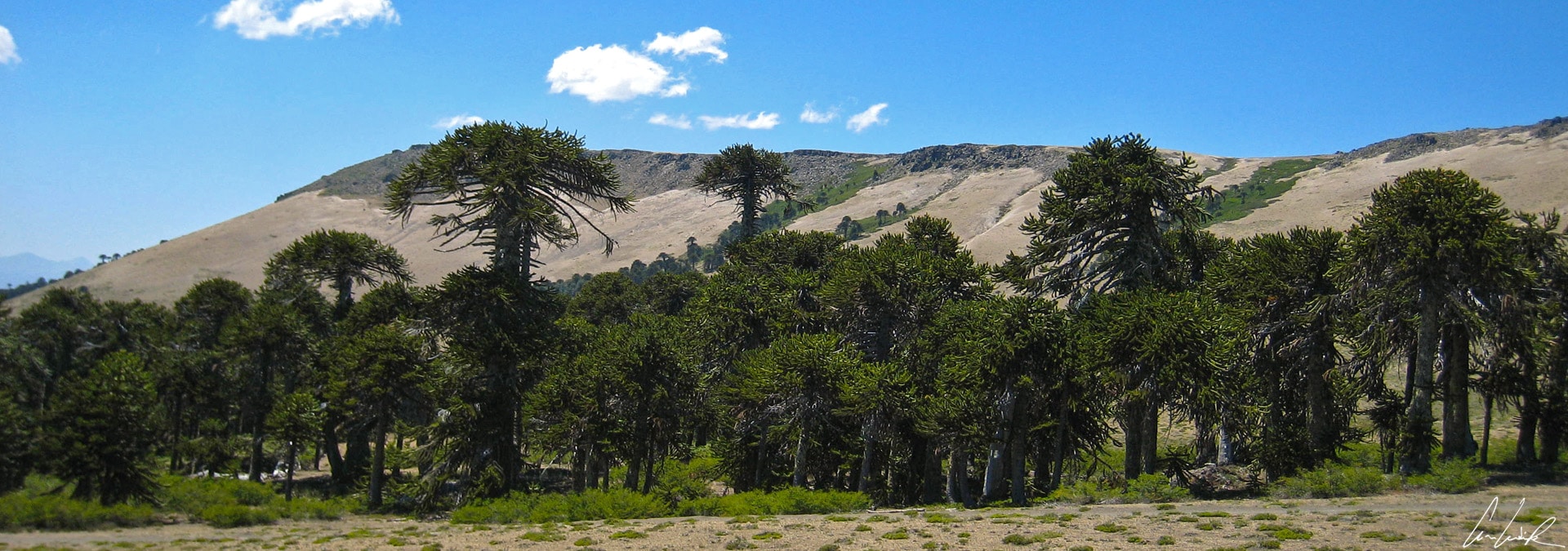
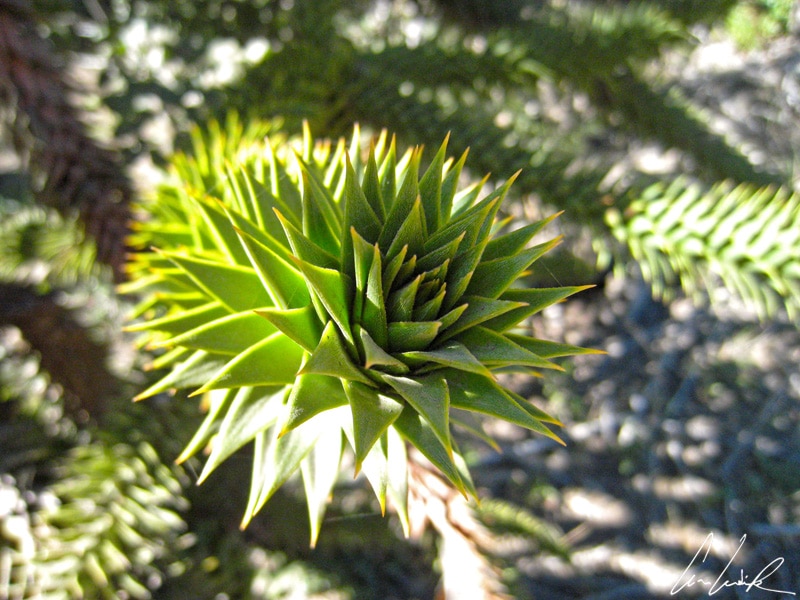
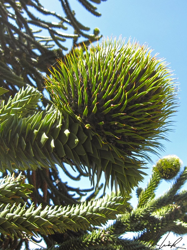
The Los Lagos Region or the Araucania is also the land of the Mapuche and the realm of the forests of Araucarias. The Conguillío National Park, 50 miles east of Temuco, was established in 1950 and designated in 1983 by UNESCO as a Biosphere Reserve, the Araucarias Biosphere Reserve. The Park is known in Chile as the Park of the Umbrellas because of its extensive forest of Araucaria trees with their distinct umbrella shape. The park has numerous lakes and vast areas of barren basalt fields where only a few lichens grow on the strange black soil. In this lunar environment, torrential streams have forged a passage known as the Saltos del Truful-Truful (meaning “leap to leap” in Mapuche language), a spectacular waterfall carved into the volcanic lava flows. The other attraction of the park is the conical Llaima volcano, one of the largest and most active volcanoes in Chile with about fifty eruptions over the last two centuries. The summit is 10,253 feet above sea level. The last eruption was in 2008. But the superstar is the Araucaria Araucana (Pehuén in Mapuche) commonly called the Monkey puzzle tree or Pehuén. It is the national tree of Chile. It gives its name to the region (Araucania) and the indigenous peoples of the area (the Araucans). This giant evergreen tree can reach 130 feet in height with a diameter up to 5 feet. It was already growing at the time of the dinosaurs, and the oldest specimens are around 2000 years old (the mother Araucaria of the park is 1800 years old). It is a sacred tree for the “Pehuenche” people, one of the tribes that comprise the Mapuche. Its umbrella-shaped can be seen from afar, perched on the ridges, overlooking the forest. Its bark, with its pattern in polygonal tiles, looks like elephant skin or a turtle shell – it is up to your imagination ! Its pointed scale-like triangular leaves, sharp, thick and tough, discourage anyone from trying to touch it… In the 1850s, the first European importer gave it the nickname “monkey puzzler”. The edible pine nut-like seeds formed an important part of the diet of the Peheunches who harvest the nuts in the forest above 3,300 feet. This evergreen is dioecious, with male and female cones on separate trees. The pine cones mature about two years after pollination. The nut-like seed is about 1.6 inches long and used for cooking. They are for sale in local markets. These ancient trees that have survived history (surely because the dinosaurs could not eat the leaves) seem straight out of Tolkien’s imagination and look like a gigantic fishbone, dead and decaying in the Lago Icalma.

The forests of Araucarias
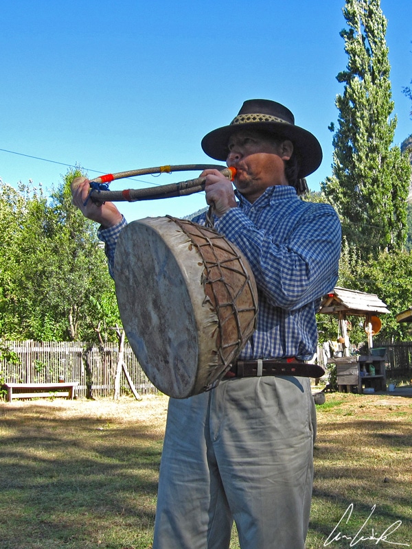
King Orélie-Antoine Ist began his memoirs with, “Les Araucaniens, on le sait, sont un peuple valeureux et jaloux de son indépendance, que le Chili a vainement essayé de dompter” meaning “The Araucanians, as we know, are brave and jealous of their independence, which Chile has vainly tried to tame”. The Mapuche – “People of the Earth” in Mapudungún “Mapu”= Earth and “Che” = people – gave a lot of trouble to the Chileans. The Mapuche constitute about 10% of the Chilean population and number more than one million. Half of the Mapuche population lives in the south of Chile in the area of Villarica and Pucón. The Mapuche territory extends from the Pacific Ocean on the west to the Andes on the east and from Rio Bío-Bío in the north to the Chacao Strait between the Chiloé island and the mainland in the south. The Mapuche culture shows the greatest respect for the land, which is conceived as community wealth and not as private property. True patrons of nature, the Mapuches have a constant connection with Mother Earth or “Ñuke Mapu”. Ñuke Mapu doesn’t refer to the soil, the geological Earth, or the Planet Earth, but it embraces a broader concept: representation of the Mapuche world within the cosmos and the interaction of the Mapuche in it within their religious beliefs. Nature and its benefits are at the center of the Mapuche beliefs. A cornerstone of their philosophy is the Machi (shaman) who performs ceremonies for curing diseases, influencing harvest, weather, protecting livestock, using his extensive knowledge of medicinal herbs for the body and the soul “Lawen”. “Oh, oh Iñche müte kümelkalelan” (I’m not doing very well), Kütrangelen (I’m sick). The Machi is also the mediator between the natural and supernatural worlds. The Mapuche maintain their traditional celebrations such as the “Nquillatún” that takes place each year in the Fall. The festival lasts between one to three days, including music, songs, dances, and rituals to express gratitude for the good harvests. Ceremonies are held in the “Ruka“, a traditional Mapuche house that is both a family residence and a meeting point for the community.
“Peukayal” (Goodbye, see you soon)


The views are truly magnificent. That is kind of place, where I would like to get with my camera. I didn’t see much of people around there though. No tourists or locals? How is it possible?
You’re right, it looks like that I am the only person in there… In fact, I have rented the place, ah, ah 😉 Chile’s Lake District has come pretty close to perfecting tourism. It’s great for adventure travel and outdoor sports, but also has outstanding local cuisine, especially seafood… Chile Turismo Rural (a government-sponsored initiative) helps rural communities in the Chilean Lake District promote authentic tourism opportunities where visitors can get off the beaten path and interact with locals !
Magnificent landscapes. One more reason to visit South America.
Traveling along the winding roads of Chile’s Lake District passing snow-capped volcanoes, lush green valleys and shimmering lakes, this is one of South America’s most picturesque areas 😉
Wow.. Araucania looks breathtaking! The snow-capped volcanoes looks incredible. Despite the tragic past of the Villarrica Volcano, it looks picturesque in your photo. It seemed like a very active volcano though. I understand there is a ski resort, but are locals still allowed to live near it?
The volcano erupted March 3th, 2015, forcing the temporary evacuation of residents and visitors… but they’re back ! The first thing you notice when arriving in Pucon in Chile’s Lake District is the smell of smoke from the wood-burning stoves that are ubiquitous around town. The next thing you notice is the volcano 😉
Very picturesque. Amazing shots and the snow capped volcano looks very graceful. Looks like you photographed during odd hours as you got clear frames. Well done
Thank you 🙂 This region has a great number of stately volcanoes, capped with eternal snow, impressively rise in the highs Andes. It’s so beautiful !!
This is so beautiful! You get a little bit of everything here Island, Mountain, and waterfalls! My husband and I mostly try to stay outdoor when we travel, but hiking is one of our big things. We also love to herp and bird watch when we hike as well. I also am into plants and flowers. So I have a hard time concentrating on all of it. There is just so much to see and not enough time!
Región de Los Lagos, is best known for its spectacular scenery made up of emerald green hills, snow-capped volcanoes, historic fishing villages, farms speckled with sheep, lush forests, national parks and – you guessed it – lots of lakes. An adventurer’s paradise for nature lovers 🙂
I love understanding the historical and mythical significance of places I visit, and so, thoroughly enjoyed the beginning of your blog. I had never hear of Araucania before reading your blog. However I do appreciate great wildernesses, and this seems to be one of them. I’ve learnt something new after reading your blog.
The Lake District is best known for its spectacular scenery ! However, in addition to the gorgeous scenery and lots of opportunities for playing outside, the area’s diverse history provides a unique mix of culture that you won’t find anyplace else 🙂
The landscape looks amazing! It’s quite cool how Chile has all these great places. I had the chance to go to PAtagonia last year, hoping to explore the Araucania region soon!
Ah, we love Patagonia ! Patagonia appears to us as if in a dream: windswept and arid steppes as far eyes can see (apparently, rain only falls horizontally!), sprawling sheep farms and endless lonely roads… You can travel hundreds of miles without seeing anyone ! Only a few horses and Ilama-like guanacos wandering freely in the landscape…
Look at these photos! They are absolutely amazing! South America is so beautiful and I hope I make it there in my nearby travels. Thanks a bunch for this share!
Mixed in with this wondrous natural beauty are plenty of interesting and quirky places to lay your head or simply take it all in. For those looking for an adventure then Chile is the place.
What an absolutely gorgeous region to visit! Your photos made me want to book to get there now 🙂
Thank you 😉 I’m happy to hear that my pictures will inspire you to discover new destinations !
Wow, I’ve never even heard of this place! It’s beautiful. Thanks for sharing it, I’ll have to add it to my list for my trip back to Chile next year!
The lake district is arguably the most visually beautiful area of the country, where volcanoes meet lakes 🙂
I’ve worked it out. A beautiful lake with snow capped mountains in the background is how to get me to fall in love with a place. So beautiful! Thanks for sharing this new discovery! What a gem to visit.
Thank you 🙂 Chile’s lake district is a region of the country that never fails to surprise and inspire those that venture here ! This is one of Chile’s top tourist attractions with its scenic area of lakes, temperate rainforest and volcanoes.
My best friend’s parents are from Chile and he is always talking about how beautiful of a country it is. Personally, I love anywhere with volcanic or mountain ranges – but seems like there is a unique range of scenery there.l on top of that.
The lakes and volcanoes Region of southern Chile is the expression of nature in its inimitable beauty and surprising exuberance ! It should definitely be on your bucket list. If it’s not, it soon will be… 🙂
It looks very mythical indeed! I love the look of that waterfall
Ah, ah, your perfectly right 😉 The forests of the Lakes District have a certain magic about them, as if a fairy or nymph is about to pop out on the trail in front of you and lead the way to the sparkling blue waterfalls.
WOW those views are epic! Are those photos all your own? You’ve captured the nature and the colours beautifully
Yes, all mine 🙂 I’m dreaming to be a nature photographer travel. This is what I love doing most…
Wow, what a beautiful looking area!! The views are stunning, and I love the different looking plants and flowers! Would be a beautiful place to go for a hike or relax by the lake with a book. So peaceful looking!
Traveller’s visiting this destination will be treated to sensational views and landscapes as well as exceptional activities such as the opportunity to hike up the volcano and unwind in a natural hot spring. Opportunities for active adventures surround you everywhere 🙂