If you are looking for a gateway into the French Alps that combines mountains, culture, and sunshine, then the Mercantour National Park is your destination. Discover Boréon, the Madonne de Fenestre, the Gordolasque valley and the prehistoric site vallée des Merveilles with its rock engravings dating back more than 5,000 years… The Mercantour National Park is located on the border with the Italian Piedmont in southeastern France about 40 miles from Nice. The park was created in 1979, covers 264 sq miles. The Mercantour massif enjoys a special place between sea and mountain. From its 10,312 feet, above sea level, the top of Gélas is the highest peak of the massif yet only 31 miles from the Mediterranean Sea as the crow flies! Besides its unique geographic location, the Mercantour also has an extensive historical heritage. Its villages contain the architectural and artistic richness of the Romanesque, medieval and baroque periods. Whether you are a botanist, a hiker, a history enthusiast, or a simple Sunday walker, there is something for you in the park. So, ready for a little ride ?

Boréon waterfall
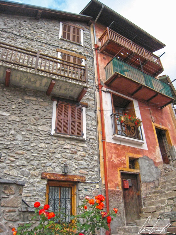
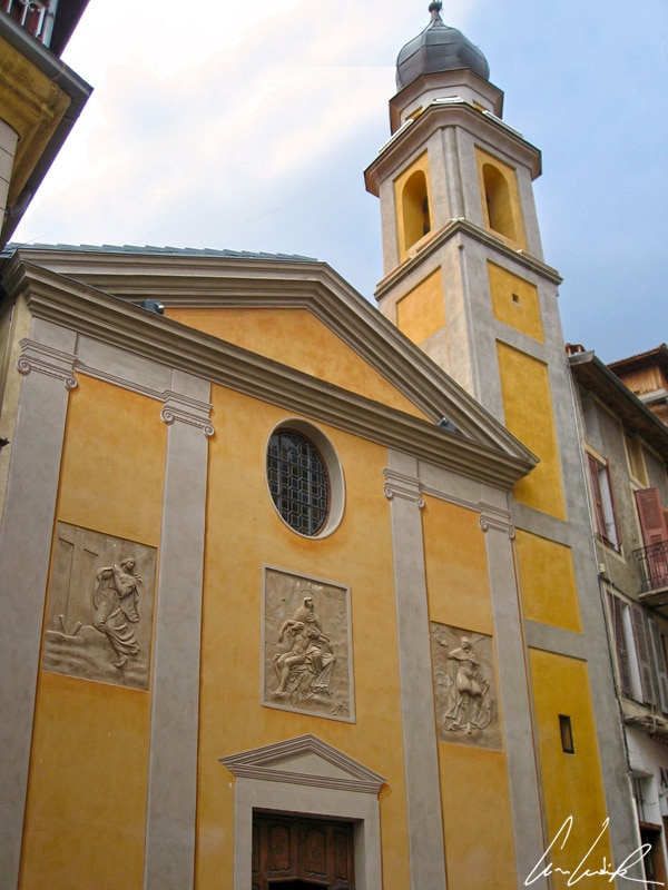
Less than 25 miles from the Mediterranean Sea, the Vallée de la Vésubie offers a landscape of high mountains. A true “gateway” to the Mercantour National Park, the picturesque village of Saint Martin Vésubie, where nature reigns supreme, is the perfect center of outdoor activities ideal for lovers of pure air. Surrounded by 14 sq miles of larch and spruce forests, sitting on a ridge 3,198 feet above sea level and squeezed between the Boréon and Madone de Fenestre valleys, this charming village was, at the beginning of the 20th century, the summer vacation retreat for the “good society” of Nice and nicknamed the “Switzerland of Nice.” Until 1891 known as Saint-Martin-Lantosque, in reference to the old name of the valley, it has been a mecca for hiking, climbing, and mountaineering since the end of the 19th century and was especially prized by Count Victor de Cessole, one of the first mountaineers. Indeed, on the Vallée de la Vésubie, several peaks exceed “9,800 feet”, including the Gélas! Near the village, do not miss the breathtaking Boréon waterfall that drops with a thunderous roar about 200 feet down a narrow gorge into the Lake Boréon. This small Lake is visited from March to October by the many fishermen who come to catch the trout fario, salmon trout, and rainbow trout… In the middle of the village, in the main street, you will be easily bewitched by the old Stone houses with wooden balconies repainted in the colors of the South. The street with granite paving, narrow and steep, has a central gargoyle (waterspout), one of only two (the other in Briançon) in the Hautes-Alpes. A curious canal, “Béal” or “lou bial”, has run through the village since the Middle Ages. The “Béal” was built in 1418 to irrigate the fields close to the dwellings and also to quench the thirst of the countless mules that went through the village carrying salt to Piedmont (the salt road was long, from Hyères to Nice and on to Piedmont). A unique construction, and one of my favorites, it has a rectangular base, surmounted by a square platform enhanced by a wooden attic and is called “the house of the hairdresser“… because it was once a hairdressing salon.

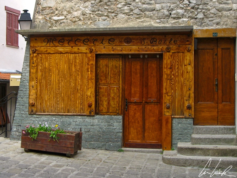
Saint Martin de Vésubie, a storefront haberdashery
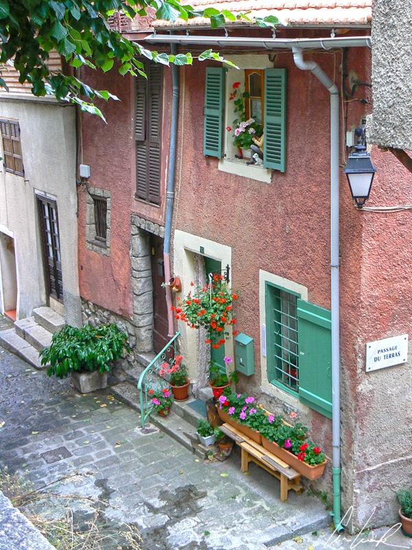
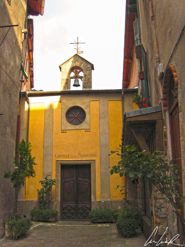
It feels like walking in the “past”, traveling in time: narrow and cobbled streets, a storefront haberdashery, an old mailbox… You will undoubtedly fall under the charm of the Town Hall dating from 1863 with its soft colors or that of the Place de la Frairie, admirable cameo of yellows, browns, and reds. Fountains gurgle and produce water nearly as pure as that of Evian… The only vestige of the walls that fortified the village in the 14th century is the broken arch of the Porte Saint Anne. Finally, Saint-Martin de Vésubie has a history steeped in the church, witness the 17th-century parish church, two main chapels, and a thousand-year-old procession to the sanctuary of the Madonna de Fenestre. After admiring its Renaissance-style façade and its Romanesque bell tower, do not hesitate to visit the sumptuous Church of Our Lady of the Assumption built in 1694 where you can admire an altarpiece signed by Louis Bréa, a painter born and active in Nice. If you have committed a lot of sins and wanted to do penance… you will be pleased: visit the tiny Chapel of the Pénitents-Noirs (Notre-Dame de la Mercy) or the Baroque Chapel of the Pénitents-Blancs (Holy Cross) or in the Chapel of the Pénitents-Bleus…

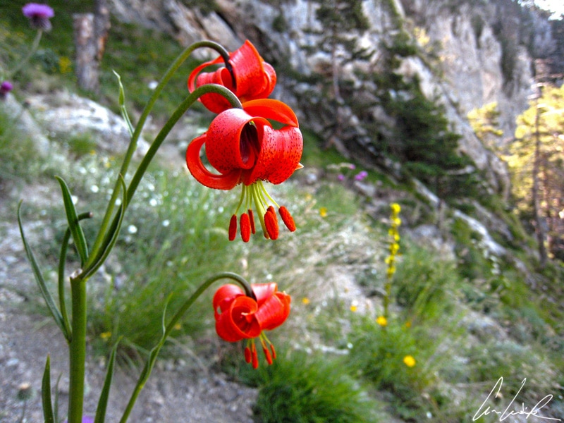
Turban Lily
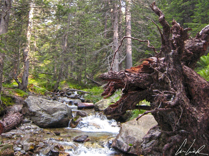
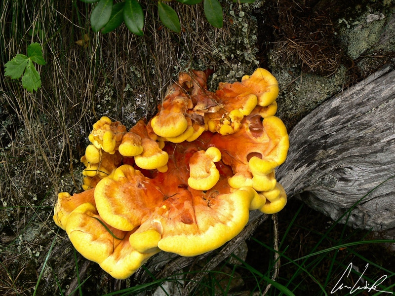
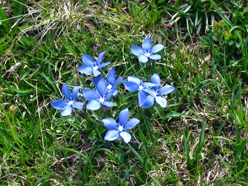
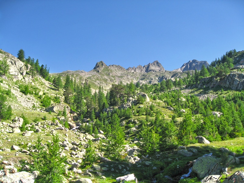
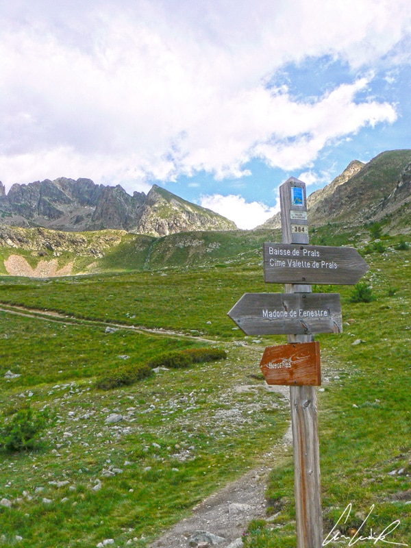
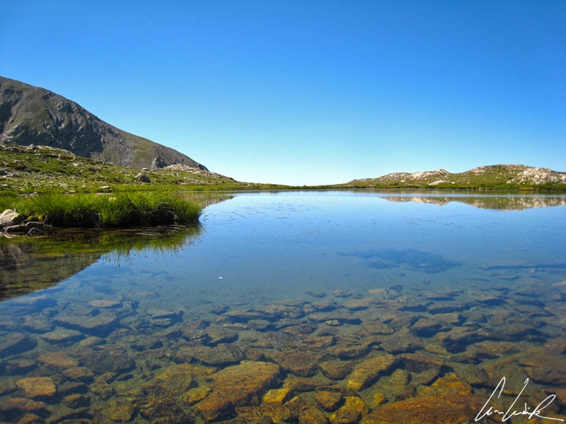
Strollers, hikers, and mountaineers will be delighted by the numerous trails that run through the surroundings of Saint Martin de Vésubie. The Mercantour reveals all its diversity when you walk along one of these trails: landscapes of lakes and mountains and also flowery meadows, giving a sweet scent to the air and mixing with the scent of the resin of pines and larches. In the heart of the Haut Boréon massif, Lake Nègre, formerly known as the Lake Noir, offers a magnificent panorama. At the foot of ocher granite walls are several trailheads. We hiked the trail that begins at the Salèse parking area at 5,480 feet above sea level, passing through the Vacherie de Salèse (5,656 feet) and continuing through a forest of larches (which deserves its title “tree of light”) and arolles where curious mushrooms (Sulfur polypore – Laetiporus sulphurous) thrive as striking golden-yellow shelf-like structures on the tree trunks. We can get carried away by the light rustle of the foliage, the distant murmur of a brook, and the discreet chirping of birds… And on an impromptu stroll through the forest, might we meet a wolf ? Let’s stroll in the woods / While the wolf is not there / If the wolf were here / He would eat us / But since he’s not here / He won’t eat us, goes the text of the French nursery rhyme, Let’s stroll in the woods. Even if after 70 years of absence, the wolf made a natural come back to the area, he would be hard to find due to his fear of man. Great, we can continue our stroll in peace! The trail is dotted with numerous tremulous streams, rapid torrents and crystalline springs like the Chardole whose water was formerly carried by mules to Saint Martin-Vésubie because of its numerous medical benefits ! The rich flora of the Mercantour is astonishing: the park contains over 2,000 plant species out of the 4,200 known in France. Of the 2,000 species, 220 are considered very rare, 40 are endemic and not found anywhere else in the world, including the one of the Saxifrage genus, a ground cover plant with multiple flower clusters. The landscape is sprinkled with a floral carpet of orchids, blue thistle, genépi, Martagon lilies, Turban lilies, gentian, edelweiss… All these fragrances tickle your nose !

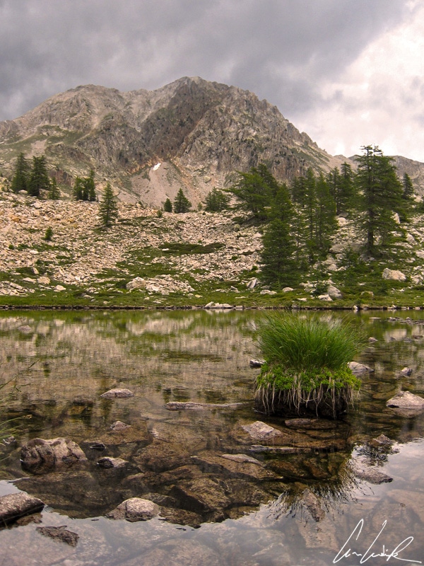
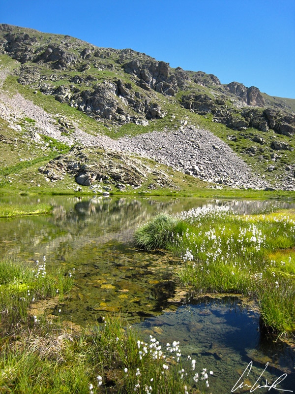
Lake Nègre
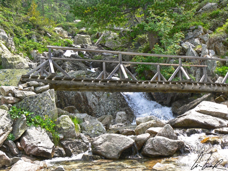
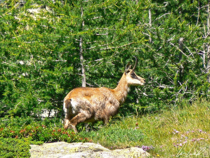
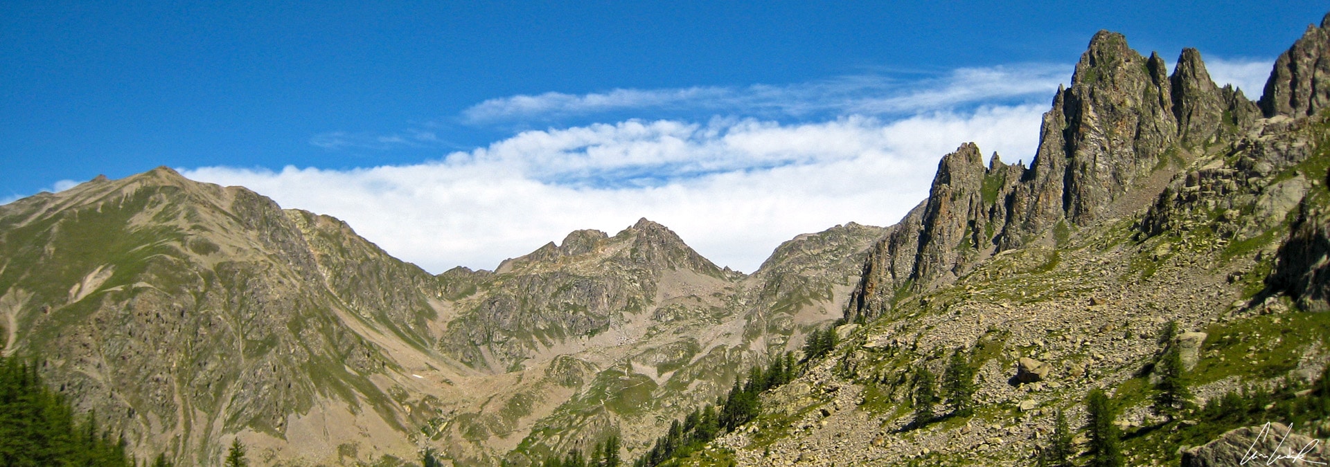
As one approaches the summits, the alpine forest gradually gives way to patches of green encircled by rock walls dotted with patches of snow. In the middle of this greenery, there are small lakes, like the lake Camp Soubran, nestled at 7,448 feet. A short, steep slope gives access to Lake Nègre at 7,724 feet above sea level, but judiciously placed blocks of granite are there to help you make your way! Finally, the reward is at the end of the path, and we are transported into another world, the one we came to look for: Lake Nègre with its rocky landscape of high mountains in opposition to the tranquil ascent through the forest. Above Lake Nègre is the Pas du Préfouns at about 8,600 feet, the favorite hunting spot of King Victor Emmanuel II of Italy. It shelters the remains of a small enclosure surrounding a horizontal slab where the King, on his noble chair, watched for chamois. Let us sit down for a moment on this “throne of earth” to contemplate the kingdom of Mother Nature. We observe on the Italian side, the Aiguilles de Questa and the Lake Nègre on the French side… There, in the middle of rhododendrons and blueberry bushes, is that a chamois ?

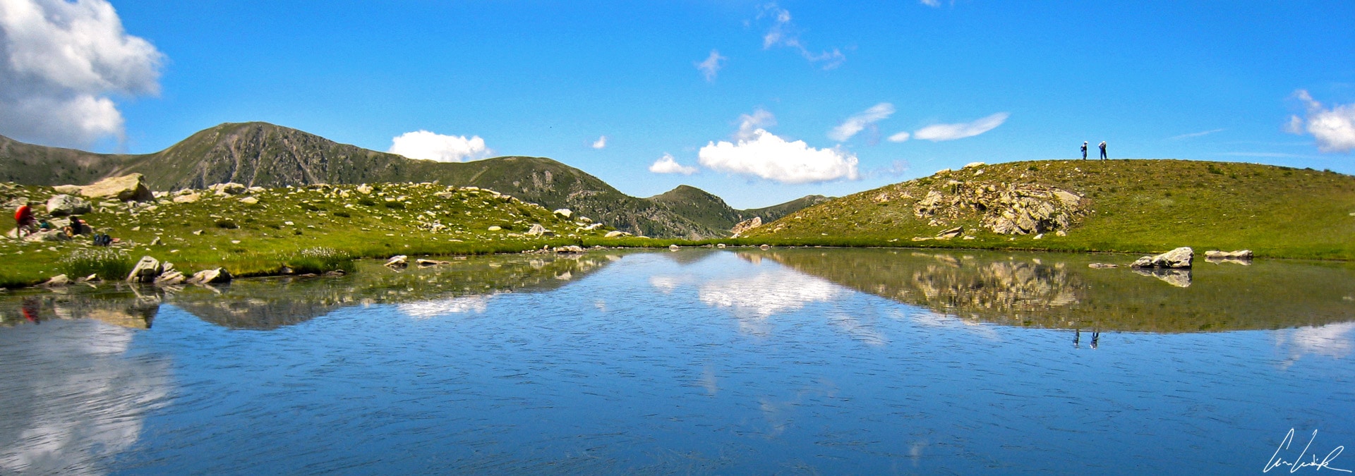
Lakes of Prals
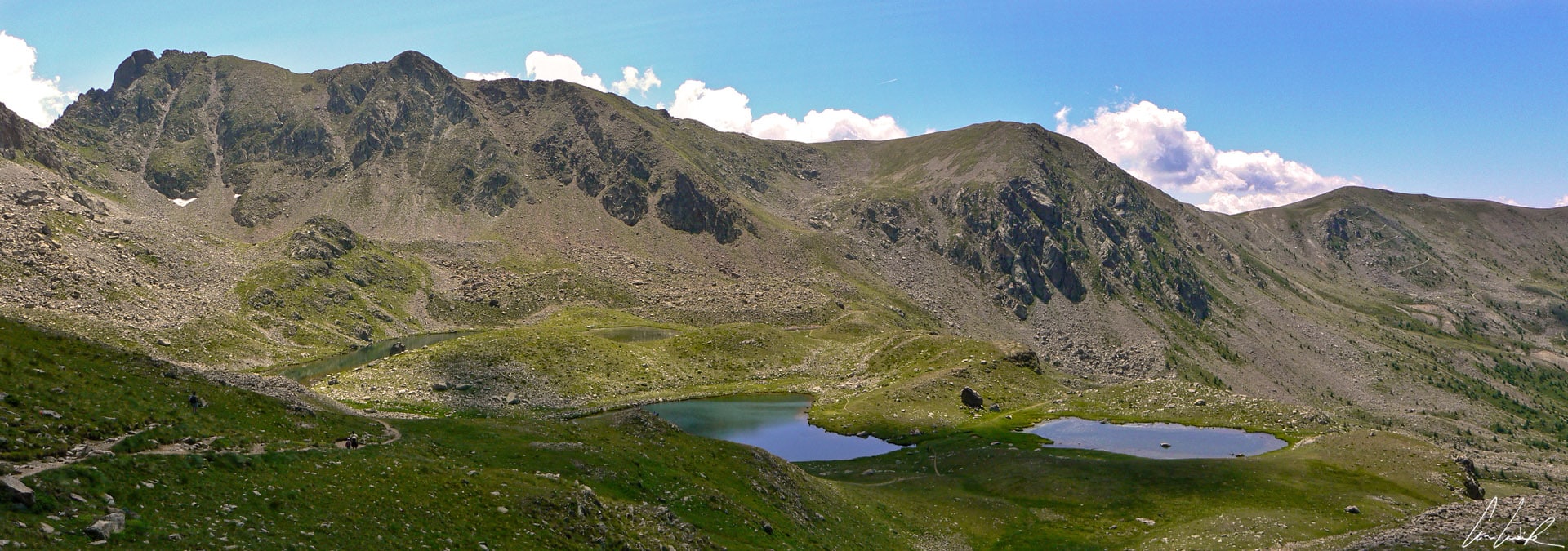
The start of a loop trail leading to the Lakes of Prals, also known as “Cinq lacs” (five lakes) is located between 7,414 and 7,480 feet above sea level. In the middle of the flowered pastures, we begin the ascent to the Vallon de Fenestre to reach the Vallon du Ponset. A plateau then leads to the final ascent to the Baisse des Cinq Lacs and to an unobstructed view of the Lakes of Prals, located just below. You almost want to hum, “La Madone (de Fenestre) au Nord / Et le lac se dessine / Courageux et fort / Où rien ne respire / Corps contre corps / Ciel contre cils / La forêt se tord / L’horizon soupire” (The Madonna (from Fenestre) to the North / And the lake appears / Courageous and strong / Where nothing breathes / Body against body / Sky against eyelashes / The forest twists / The horizon sighs) by French singer, Julien Doré, Le Lac. The location is magnificent: a vast green corridor, covered with beautiful forests and meadows split by rivers, rocky vertiginous walls… a nature so pure, so beautiful ! Surrounded by the ridges of Mount Neiglier (9,140 feet) and the summit of Paranova (8,386 feet), these five lakes with open, grassy shores are shallow but only the brave will swim. The water is about 55°F ! Like the five fingers on a hand, each lake has its peculiarity: there is the shallowest, the longest, the largest, the one bordered by stony slopes, and the one containing a lot of algae. It’s up to you to decide which lake suits you the best ! The way back via the Vallon de Prals, along a refreshing river and through the middle of a forest of larches and spruces, is very pleasant. This trail brings us to the Vacherie de Madonne de Fenestre where, of course, we can buy a local cheese… Any effort deserves a reward, doesn’t it ? Accompanied with a tart of Swiss chard or a Socca cooked in a wood oven, it will be the perfect evening meal !

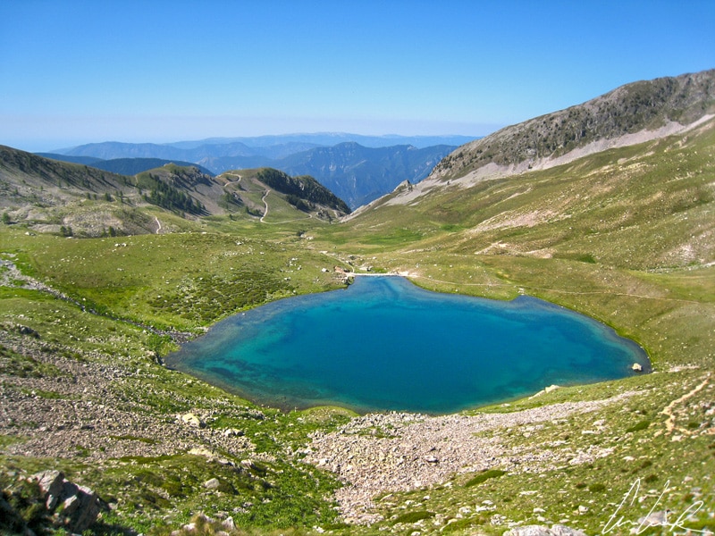
Lake Petit
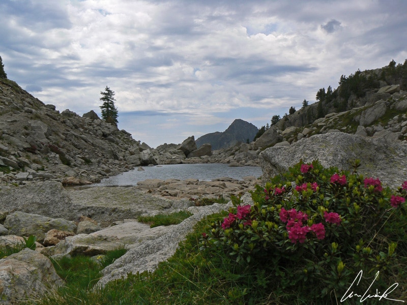
If you are more like four Musketeers than five fingers of a hand, then you are strongly advised to take the circuit of Lakes Millefonts with four lakes in the middle of an exceptional setting. This hike starts with a path that follows the ridges of a grassy slope. After a short climb across gravel, we discover Lake Petit at an altitude of about 7,300 feet. Contrary to its name, it is actually the biggest lake and was created for irrigation in 1945 by a dam. Continuing the ascent, you reach Lake Long at 7,693 feet above sea level, from which you have a stunning view of the ridges of Cheiron in the distance… And you climb again and again to reach Lake Gros at 7,792 feet the most enclosed of the four lakes. Its original level was nearly 33 feet above its present level (would it have been subjected to a dry diet ?), and it was once the largest and deepest of the Lakes Millefonts, thus justifying its name… whereas today it is smaller than Lake Petit… paradoxical, isn’t it ? After passing close to the Lake Rond (often dry in late summer) make a final effort from there is only a slight ascent to a magnificent panorama. Here you are the Barn pass (8,045 feet above sea level) with its breathtaking view of the Molières valley, the Gieng point, the tête des Tablesses, the Fremamorte peak, and the Agnel peak.
Discover my others articles about France
- Normandy, between “War and Peace”
- Looking back at the beaches of Normandy on D-Day
- The Mercantour: destination Merveilles


I am so happy i came across your blog! Lovely pics and great content 🙂
Thank you ! France is a rich and diverse country. You need to take your time to discover it 😉
Sometimes I feel like I miss out how my own country is beautiful ! Your photography really captured the beauty of those gorgeous lakes and vallons.
Love the Turban Lily too, I had never seen this kind of flowers before !
Thank you 🙂 Sometimes it is good to be a tourist in your own country, because you come to places where you usually would not go to and you experience your country from a totally different perspective…
This is absolutely beautiful! So far I’ve only been to Paris and Nice, but I’d love to visit more of the French countryside and the alps!
If France is the country welcoming the most tourists in the world, it must certainly be because of the diversity of its regions and of its landscapes. Monuments, landscapes and wonderfull cities are to be discovered everywhere 😉
Such a pretty description of a very pretty place. Really enjoyed reading.
Thank you 🙂 It is an outstanding destination which is worth visiting !
Wow! I had never heard of the Mercantour National Park before, and it looks like one amazing place. I definitely agree that it looks like you’re travelling back in time when you visit the village, and that’s always an amazing experience. That turban lily is quite stunning too!
With it’s unbelievably villages and breathtaking natural allures, the Mercantour should definitely be on your travel bucket list. If it’s not, it soon will be… 🙂
Mercantour looks like such a beautiful place! This post introduced me to Lake Negre, and I am OBSESSED! What a beauty! -@ressamazing
The hike to the Lake Nègre is beautiful and easy. You meander through the forest and slowly climb up through the trees, crossing bridges over fast flowing water. You often stop to look back into the valley below… It is breathtakingly beautiful.
I’d never heard of Mercantour and now I’m OBSESSED!! What a picturesque place! I need to get myself to the French Countryside stat! Thanks for sharing.
Not far from Nice, there are beautiful mountains, forests and lakes just waiting to be explored ! You can climb a mountain, find a lake and see some amazing views in the Mercantour National Park 🙂
This place looks amazing! I’ve heard that the french country side should be beautiful but this is just amazing!!
France is a land of diversity 😉 It would really be a shame to consider its famous capital city only because the rest of the country is filled with countless treasures. Monuments, landscapes and wonderfull cities are to be discovered everywhere !
Even without the pictures, your writing was so descriptive that I was able to imagine walking down cobblestone streets, etc. It is pretty cool that Mercantour is like going back in time. Great post and amazing pictures.
Thank you 🙂 We stroll with pleasure through the narrow cobbled and steep streets, lined with old houses in the style of mountain villages… I just close my eyes and I feel transported elsewhere, into another time !
So many great facts here! Like the fact that the Petite Lac is actually quite big haha. I can’t believe I had never heard of Mercantour before!!
The Mercantour National Park seems like an awesome place to visit and a truly picturesque hiking destination. How long would you recommend staying there?